
Colquitt County | |
|---|---|
 Colquitt County Courthouse in Moultrie | |
 Location within the U.S. state of Georgia | |
 Georgia's location within the U.S. | |
| Coordinates: 31°11′N 83°46′W / 31.19°N 83.77°W | |
| Country | |
| State | |
| Founded | 1856 |
| Named for | Walter Terry Colquitt |
| Seat | Moultrie |
| Largest city | Moultrie |
| Area | |
| • Total | 557 sq mi (1,440 km2) |
| • Land | 544 sq mi (1,410 km2) |
| • Water | 12 sq mi (30 km2) 2.2% |
| Population (2020) | |
| • Total | 45,898 |
| • Density | 84/sq mi (32/km2) |
| Time zone | UTC−5 (Eastern) |
| • Summer (DST) | UTC−4 (EDT) |
| Congressional district | 8th |
| Website | www |
Colquitt County is a county in the U.S. state of Georgia. As of the 2020 census, the population was 45,898.[1] The county seat is Moultrie.[2] The county was created on February 25, 1856, and is named for Walter Terry Colquitt, a U.S. senator.[3] Colquitt County comprises the Moultrie, GA micropolitan statistical area.
YouTube Encyclopedic
-
1/1Views:451
-
More Georgia Backroads - Colquitt County and Dairy Farming
Transcription
Geography
According to the U.S. Census Bureau, the county has a total area of 557 square miles (1,440 km2), of which 544 square miles (1,410 km2) is land and 12 square miles (31 km2) (2.2%) is water.[4] It is located in Southwest Georgia.
Most of the western portion of Colquitt County, west of Moultrie and State Route 33, is located in the Upper Ochlockonee River sub-basin of the larger Ochlockonee River basin, with the exception of the very northwestern corner of the county, between Sale City and west of Doerun, which is located in the Lower Flint River sub-basin of the ACF River Basin (Apalachicola-Chattahoochee-Flint River Basin). A narrow central portion of Colquitt County, running from north to south of Moultrie, and then widening to occupy the gap between U.S. Route 319 and State Route 133, is located in the Withlacoochee River sub-basin of the Suwannee River basin. The eastern portion of the county is located in the Little River sub-basin of the same Suwannee River basin.[5]
Lakes
Major highways
Adjacent counties
- Tift County (northeast)
- Cook County (east)
- Brooks County (southeast)
- Thomas County (southwest)
- Mitchell County (west)
- Worth County (northwest)
Communities
Cities
Unincorporated communities
Demographics
| Census | Pop. | Note | %± |
|---|---|---|---|
| 1860 | 1,316 | — | |
| 1870 | 1,654 | 25.7% | |
| 1880 | 2,527 | 52.8% | |
| 1890 | 4,794 | 89.7% | |
| 1900 | 13,636 | 184.4% | |
| 1910 | 19,789 | 45.1% | |
| 1920 | 29,332 | 48.2% | |
| 1930 | 30,622 | 4.4% | |
| 1940 | 33,012 | 7.8% | |
| 1950 | 33,999 | 3.0% | |
| 1960 | 34,048 | 0.1% | |
| 1970 | 32,200 | −5.4% | |
| 1980 | 35,376 | 9.9% | |
| 1990 | 36,645 | 3.6% | |
| 2000 | 42,053 | 14.8% | |
| 2010 | 45,498 | 8.2% | |
| 2020 | 45,898 | 0.9% | |
| 2023 (est.) | 46,167 | [6] | 0.6% |
| U.S. Decennial Census[7] 1790-1880[8]1890-1910[9] 1920-1930[10] 1930-1940[11] 1940-1950[12] 1960-1980[13] 1980-2000[14] 2010[15] | |||
| Race | Num. | Perc. |
|---|---|---|
| White | 25,588 | 55.75% |
| Black or African American | 9,995 | 21.78% |
| Native American | 83 | 0.18% |
| Asian | 388 | 0.85% |
| Pacific Islander | 15 | 0.03% |
| Other/mixed | 1,120 | 2.44% |
| Hispanic or Latino | 8,709 | 18.97% |
As of the 2020 United States census, there were 45,898 people, 15,505 households, and 10,663 families residing in the county.
Education

Colquitt County School District operates public schools, with Colquitt County High School being the high school.
Politics
| Year | Republican | Democratic | Third party | |||
|---|---|---|---|---|---|---|
| No. | % | No. | % | No. | % | |
| 2020 | 11,777 | 73.21% | 4,190 | 26.05% | 119 | 0.74% |
| 2016 | 9,898 | 72.65% | 3,463 | 25.42% | 263 | 1.93% |
| 2012 | 9,243 | 69.25% | 3,973 | 29.77% | 131 | 0.98% |
| 2008 | 9,185 | 68.27% | 4,139 | 30.76% | 130 | 0.97% |
| 2004 | 8,296 | 70.59% | 3,378 | 28.74% | 78 | 0.66% |
| 2000 | 6,589 | 66.08% | 3,297 | 33.06% | 86 | 0.86% |
| 1996 | 4,847 | 48.51% | 4,135 | 41.38% | 1,010 | 10.11% |
| 1992 | 4,680 | 45.54% | 3,891 | 37.86% | 1,705 | 16.59% |
| 1988 | 5,653 | 65.04% | 2,998 | 34.50% | 40 | 0.46% |
| 1984 | 5,815 | 64.45% | 3,208 | 35.55% | 0 | 0.00% |
| 1980 | 3,593 | 39.62% | 5,353 | 59.03% | 123 | 1.36% |
| 1976 | 2,181 | 23.94% | 6,928 | 76.06% | 0 | 0.00% |
| 1972 | 6,900 | 88.12% | 930 | 11.88% | 0 | 0.00% |
| 1968 | 1,882 | 20.18% | 1,119 | 12.00% | 6,325 | 67.82% |
| 1964 | 6,493 | 71.67% | 2,563 | 28.29% | 4 | 0.04% |
| 1960 | 1,685 | 27.70% | 4,397 | 72.30% | 0 | 0.00% |
| 1956 | 1,336 | 23.24% | 4,412 | 76.76% | 0 | 0.00% |
| 1952 | 1,411 | 23.80% | 4,517 | 76.20% | 0 | 0.00% |
| 1948 | 537 | 15.50% | 2,255 | 65.08% | 673 | 19.42% |
| 1944 | 696 | 23.17% | 2,308 | 76.83% | 0 | 0.00% |
| 1940 | 525 | 22.24% | 1,819 | 77.04% | 17 | 0.72% |
| 1936 | 448 | 15.44% | 2,449 | 84.42% | 4 | 0.14% |
| 1932 | 101 | 2.77% | 3,534 | 96.77% | 17 | 0.47% |
| 1928 | 796 | 45.07% | 970 | 54.93% | 0 | 0.00% |
| 1924 | 205 | 10.67% | 1,572 | 81.79% | 145 | 7.54% |
| 1920 | 523 | 40.51% | 768 | 59.49% | 0 | 0.00% |
| 1916 | 53 | 3.47% | 1,305 | 85.35% | 171 | 11.18% |
| 1912 | 8 | 0.66% | 699 | 57.58% | 507 | 41.76% |
See also
- National Register of Historic Places listings in Colquitt County, Georgia
- List of counties in Georgia
References
- ^ "Census - Geography Profile: Colquitt County, Georgia". United States Census Bureau. Retrieved December 26, 2022.
- ^ "Find a County". National Association of Counties. Archived from the original on May 31, 2011. Retrieved June 7, 2011.
- ^ Krakow, Kenneth K. (1975). Georgia Place-Names: Their History and Origins (PDF). Macon, GA: Winship Press. p. 49. ISBN 0-915430-00-2. Archived (PDF) from the original on July 10, 2003.
- ^ "US Gazetteer files: 2010, 2000, and 1990". United States Census Bureau. February 12, 2011. Retrieved April 23, 2011.
- ^ "Georgia Soil and Water Conservation Commission Interactive Mapping Experience". Georgia Soil and Water Conservation Commission. Archived from the original on October 3, 2018. Retrieved November 25, 2015.
- ^ "Annual Estimates of the Resident Population for Counties: April 1, 2020 to July 1, 2023". United States Census Bureau. Retrieved March 31, 2024.
- ^ "Decennial Census of Population and Housing by Decades". US Census Bureau.
- ^ "1880 Census Population by Counties 1790-1800" (PDF). US Census Bureau. 1880.
- ^ "1910 Census of Population - Georgia" (PDF). US Census Bureau. 1910.
- ^ "1930 Census of Population - Georgia" (PDF). US Census Bureau. 1930.
- ^ "1940 Census of Population - Georgia" (PDF). US Census Bureau. 1940.
- ^ "1950 Census of Population - Georgia -" (PDF). US Census Bureau. 1950.
- ^ "1980 Census of Population - Number of Inhabitants - Georgia" (PDF). US Census Bureau. 1980.
- ^ "2000 Census of Population - Population and Housing Unit Counts - Georgia" (PDF). US Census Bureau. 2000.
- ^ "State & County QuickFacts". United States Census Bureau. Archived from the original on February 26, 2016. Retrieved June 20, 2014.
- ^ "Explore Census Data". data.census.gov. Retrieved December 9, 2021.
- ^ Leip, David. "Dave Leip's Atlas of U.S. Presidential Elections". uselectionatlas.org. Retrieved March 19, 2018.
External links
- Colquitt County official website
- Colquitt County historical marker
Places adjacent to Colquitt County, Georgia | ||||||||||||||||
|---|---|---|---|---|---|---|---|---|---|---|---|---|---|---|---|---|
| ||||||||||||||||
Municipalities and communities of Colquitt County, Georgia, United States | ||
|---|---|---|
| Cities | 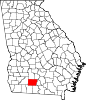 | |
| Towns | ||
| Unincorporated communities | ||
| Footnotes | ‡This populated place also has portions in an adjacent county or counties | |
| International | |
|---|---|
| National | |
| Other | |
31°11′N 83°46′W / 31.19°N 83.77°W