
Sapanca | |
|---|---|
District and municipality | |
 Sapanca city center | |
 Map showing Sapanca District in Sakarya Province | |
 Sapanca Location in Turkey  Sapanca Sapanca (Marmara) | |
| Coordinates: 40°41′26″N 30°16′13″E / 40.69056°N 30.27028°E | |
| Country | Turkey |
| Province | Sakarya |
| Government | |
| • Mayor | Özcan Özen (AKP) |
| Area | 173 km2 (67 sq mi) |
| Population (2023 (Official number))[1] | 46,080 |
| • Density | 270/km2 (690/sq mi) |
| Time zone | UTC+3 (TRT) |
| Postal code | 54600 |
| Area code | 0264 |
| Climate | Cfa |
| Website | www |
Sapanca is a municipality and district of Sakarya Province, Turkey.[2] Its area is 173 km2,[3] and its population is 44,712 (2022).[1] It lies on the south bank of Lake Sapanca. The town's mayor is Özcan Özen (AKP).
Sapanca has recently become a tourist destination, due to its stunning natural environment and its lake, as well as its proximity to Istanbul and the city of İzmit, also known as Kocaeli. The town has a number of hotels and resorts.[citation needed]
YouTube Encyclopedic
-
1/3Views:4 26664 365883
-
Yoldayken 1 Bolum - Sapanca Gölü ve Maşukiye
-
Sapanca & Masukiye Trip - رحلة صابنجة و معشوقية (snow)
-
Sapanca & Masukiye Trip - رحلة صابنجة و معشوقية (snow)
Transcription
Composition
There are 29 neighbourhoods in Sapanca District:[4]
- Akçay
- Balkaya
- Camicedit
- Çayiçi
- Fevziye
- Gazipaşa
- Göl
- Güldibi
- Hacımercan
- İkramiye
- İlmiye
- İstanbuldere
- Kırkpınar Hasanpaşa
- Kırkpınar Soğuksu
- Kırkpınar Tepebaşı
- Kurtköy Dibektaş
- Kurtköy Fatih
- Kurtköy Yavuzselim
- Kuruçeşme
- Mahmudiye
- Memnuniye
- Muradiye
- Nailiye
- Rüstempaşa
- Şükriye
- Ünlüce
- Uzunkum
- Yanık
- Yenimahalle
References
- ^ a b "Address-based population registration system (ADNKS) results dated 31 December 2022, Favorite Reports" (XLS). TÜİK. Retrieved 19 September 2023.
- ^ Büyükşehir İlçe Belediyesi, Turkey Civil Administration Departments Inventory. Retrieved 19 September 2023.
- ^ "İl ve İlçe Yüz ölçümleri". General Directorate of Mapping. Retrieved 19 September 2023.
- ^ Mahalle, Turkey Civil Administration Departments Inventory. Retrieved 19 September 2023.
External links
Sapanca in Sakarya Province of Turkey | |||||||||||||||||||||||||||
|---|---|---|---|---|---|---|---|---|---|---|---|---|---|---|---|---|---|---|---|---|---|---|---|---|---|---|---|
| Districts |  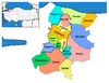 | ||||||||||||||||||||||||||
|
Metropolitan municipalities are bolded. | |||||||||||||||||||||||||||
| International | |
|---|---|
| National | |
| Other | |
This geographical article about a location in Sakarya Province, Turkey is a stub. You can help Wikipedia by expanding it. |