
Arifiye | |
|---|---|
District and municipality | |
 Map showing Arifiye District in Sakarya Province | |
 Arifiye Location in Turkey  Arifiye Arifiye (Marmara) | |
| Coordinates: 40°43′N 30°22′E / 40.717°N 30.367°E | |
| Country | Turkey |
| Province | Sakarya |
| Government | |
| • Mayor | İsmail Karakullukçu (AKP) |
| Area | 75 km2 (29 sq mi) |
| Elevation | 40 m (130 ft) |
| Population (2022)[1] | 49,340 |
| • Density | 660/km2 (1,700/sq mi) |
| Time zone | UTC+3 (TRT) |
| Postal code | 54580 |
| Area code | 0264 |
| Climate | Cfa |
| Website | www |
Arifiye is a municipality and district of Sakarya Province, Turkey.[2] Its area is 75 km2,[3] and its population is 49,340 (2022).[1] It covers the southernmost part of the agglomeration of Adapazarı and the adjacent countryside.
YouTube Encyclopedic
-
1/3Views:6331 7882 184
-
Arifiye Mesleki ve Teknik Anadolu Lisesi Tanıtım Videosu
-
Arifiye AÖL 2008
-
Arifiye Gölya Tabiat Parkı.
Transcription
Geography
Arifiye is situated just at the east of Lake Sapanca. It is almost merged to Adapazarı the center of the province and it is a part of Greater Sakarya. (see Metropolitan centers in Turkey). Arifiye is on Turkish Motorway O-4 and state highway D.100 both of which connect Istanbul to Ankara. It is also an important railway junction.
History
Arifiye is a part of ancient region of Bithynia. It later on fell to Roman Empire and Byzantine Empire. Several times it was plundered by the Sassanid Persians, Umayyad Arabs and Russians in the Middle Ages. After a brief occupation by the Seljuk Turks it was returned to Byzantines during the First Crusade. In 1326 Ottoman Turks annexed Arifiye. Although an important stop on Silk Road in the Middle Ages because of frequent floods of the nearby Lake Sapanca it was not a populous settlement. During Turkish Republic its population increased and by 1956 it was declared a seat of township. In 2008 the district Arifiye was created from part of the former central district of Adapazarı/Sakarya Province, along with the districts Adapazarı, Erenler and Serdivan.[4][5][6]
Economy
Formerly the major economic sector in Arifiye was agriculture. But after the 1970s Arifiye became an important center of Automotive sub industry. Toyota is making the new C-HR here. The bus terminal of Greater Sakarya is also in Arifiye. The Arifiye railway station is served by high speed trains between Istanbul and Ankara, and by the commuter service between Gebze and Adapazarı. It was the westernmost terminal of the Adana-Istanbul railway from February 2012 to 2015, while construction took place in Istanbul's Haydarpaşa train station.[7]
Composition
There are 24 neighbourhoods in Arifiye District:[8]
- Adliye
- Ahmediye
- Arifbey
- Aşağı Kirazca
- Boğazköy
- Çaybaşıfuadiye
- Çınardibi
- Cumhuriyet
- Fatih
- Hacıköy
- Hanlı Merkez
- Hanlı Sakarya
- Hanlıköy
- Karaaptiler
- Karaçomaklar
- Kemaliye
- Kirazca
- Kışlaçay
- Kumbaşı
- Mollaköy
- Neviye
- Semerciler
- Türkçaybaşı
- Yukarıkirazca
References
- ^ a b "Address-based population registration system (ADNKS) results dated 31 December 2022, Favorite Reports" (XLS). TÜİK. Retrieved 19 September 2023.
- ^ Büyükşehir İlçe Belediyesi, Turkey Civil Administration Departments Inventory. Retrieved 19 September 2023.
- ^ "İl ve İlçe Yüz ölçümleri". General Directorate of Mapping. Retrieved 19 September 2023.
- ^ Kanun No. 5747, Resmî Gazete, 22 March 2008.
- ^ "İl İdaresi ve Mülki Bölümler Şube Müdürlüğü İstatistikleri - İl ve İlçe Kuruluş Tarihleri" (PDF) (in Turkish). p. 71. Retrieved 12 October 2023.
- ^ Mayor's page (in Turkish) Archived December 17, 2011, at the Wayback Machine
- ^ Man in Seat Sixty-One, The. "Train Travel in Turkey". Seat61.com.
- ^ Mahalle, Turkey Civil Administration Departments Inventory. Retrieved 19 September 2023.
Arifiye in Sakarya Province of Turkey | |||||||||||||||||||||||||||
|---|---|---|---|---|---|---|---|---|---|---|---|---|---|---|---|---|---|---|---|---|---|---|---|---|---|---|---|
| Districts |  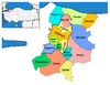 | ||||||||||||||||||||||||||
|
Metropolitan municipalities are bolded. | |||||||||||||||||||||||||||