
Pamukova | |
|---|---|
District and municipality | |
 | |
 Map showing Pamukova District in Sakarya Province | |
 Pamukova Location in Turkey  Pamukova Pamukova (Marmara) | |
| Coordinates: 40°31′N 30°10′E / 40.517°N 30.167°E | |
| Country | Turkey |
| Province | Sakarya |
| Government | |
| • Mayor | İbrahim Güven Övün (SP) |
| Area | 289 km2 (112 sq mi) |
| Population (2022)[1] | 30,482 |
| • Density | 110/km2 (270/sq mi) |
| Time zone | TRT (UTC+3) |
| Postal code | 54900 |
| Area code | 0264 |
| Climate | Csa |
| Website | www |
Pamukova is a municipality and district of Sakarya Province, Turkey.[2] Its area is 289 km2,[3] and its population is 30,482 (2022).[1] The mayor is İbrahim Güven Övün (SP). The town has been identified as the Byzantine assembly place of Malagina.[4][5]
Composition
There are 33 neighbourhoods in Pamukova District:[6]
- Ağaççılar
- Ahılar
- Akçakaya
- Bacıköy
- Bakacak
- Bayırakçaşehir
- Çardak
- Cihadiye
- Çilekli
- Cumhuriyet
- Eğriçay
- Elperek
- Eskiyayla
- Fevziye
- Gökgöz
- Gonca
- Hayrettin
- Hüseyinli
- İsabalı
- Kadıköy
- Karapınar
- Kazımiye
- Kemaliye
- Mekece
- Oruçlu
- Özbek
- Paşalar
- Pınarlı
- Şahmelek
- Şeyhvarmaz
- Teşvikiye
- Turgutlu
- Yenice
References
Wikimedia Commons has media related to Pamukova.
- ^ a b "Address-based population registration system (ADNKS) results dated 31 December 2022, Favorite Reports" (XLS). TÜİK. Retrieved 19 September 2023.
- ^ Büyükşehir İlçe Belediyesi, Turkey Civil Administration Departments Inventory. Retrieved 19 September 2023.
- ^ "İl ve İlçe Yüz ölçümleri". General Directorate of Mapping. Retrieved 19 September 2023.
- ^ Kontogiannis, Nikos D. (June 2022). Byzantine Fortifications Protecting the Roman Empire in the East. Pen & Sword Books. ISBN 9781526710277. Retrieved 26 September 2023.
- ^ Foss, Clive (1990), "Byzantine Malagina and the Lower Sangarius", Anatolian Studies, British Institute at Ankara, 40: 161–183, doi:10.2307/3642800, JSTOR 3642800, S2CID 191380626
- ^ Mahalle, Turkey Civil Administration Departments Inventory. Retrieved 19 September 2023.
Pamukova in Sakarya Province of Turkey | |||||||||||||||||||||||||||
|---|---|---|---|---|---|---|---|---|---|---|---|---|---|---|---|---|---|---|---|---|---|---|---|---|---|---|---|
| Districts |  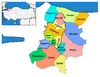 | ||||||||||||||||||||||||||
|
Metropolitan municipalities are bolded. | |||||||||||||||||||||||||||
This geographical article about a location in Sakarya Province, Turkey is a stub. You can help Wikipedia by expanding it. |