
Karapürçek | |
|---|---|
District and municipality | |
 Map showing Karapürçek District in Sakarya Province | |
 Karapürçek Location in Turkey  Karapürçek Karapürçek (Marmara) | |
| Coordinates: 40°38′33″N 30°32′19″E / 40.64250°N 30.53861°E | |
| Country | Turkey |
| Province | Sakarya |
| Government | |
| • Mayor | Orhan Yıldırım (AKP) |
| Area | 142 km2 (55 sq mi) |
| Elevation | 150 m (490 ft) |
| Population (2022)[1] | 13,339 |
| • Density | 94/km2 (240/sq mi) |
| Time zone | TRT (UTC+3) |
| Postal code | 54430 |
| Area code | 0264 |
| Climate | Cfa |
| Website | www |
Karapürçek is a municipality and district of Sakarya Province, Turkey.[2] Its area is 142 km2,[3] and its population is 13,339 (2022).[1] The mayor is Orhan Yıldırım (AKP).
YouTube Encyclopedic
-
1/2Views:14 370754
-
KARAPÜRÇEK ORTAOKULU "MUALLİM" ŞARKISI KLİBİ :D (öğretmenler gününe özel)
-
Japon Pazarı Karapürçek
Transcription
Composition
There are 14 neighbourhoods in Karapürçek District:[4]
- Ahmediye
- Ahmetler
- Çeşmebaşı
- Cumhuriyet
- Hocaköy
- İnönü
- Kanlıçay
- Kızılbayır
- Küçükkarapürçek
- Mecidiye
- Meşepınarı
- Mesudiye
- Yazılıgürgen
- Yüksel
References
- ^ a b "Address-based population registration system (ADNKS) results dated 31 December 2022, Favorite Reports" (XLS). TÜİK. Retrieved 19 September 2023.
- ^ Büyükşehir İlçe Belediyesi, Turkey Civil Administration Departments Inventory. Retrieved 19 September 2023.
- ^ "İl ve İlçe Yüz ölçümleri". General Directorate of Mapping. Retrieved 19 September 2023.
- ^ Mahalle, Turkey Civil Administration Departments Inventory. Retrieved 19 September 2023.
Karapürçek in Sakarya Province of Turkey | |||||||||||||||||||||||||||
|---|---|---|---|---|---|---|---|---|---|---|---|---|---|---|---|---|---|---|---|---|---|---|---|---|---|---|---|
| Districts |  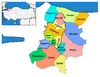 | ||||||||||||||||||||||||||
|
Metropolitan municipalities are bolded. | |||||||||||||||||||||||||||
This geographical article about a location in Sakarya Province, Turkey is a stub. You can help Wikipedia by expanding it. |