
Erenler | |
|---|---|
District and municipality | |
 Map showing Erenler District in Sakarya Province | |
 Erenler Location in Turkey  Erenler Erenler (Marmara) | |
| Coordinates: 40°45′N 30°25′E / 40.750°N 30.417°E | |
| Country | Turkey |
| Province | Sakarya |
| Government | |
| • Mayor | Rahmi Şengül |
| Area | 136 km2 (53 sq mi) |
| Elevation | 32 m (105 ft) |
| Population (2022)[1] | 92,249 |
| • Density | 680/km2 (1,800/sq mi) |
| Time zone | TRT (UTC+3) |
| Postal code | 54200 |
| Area code | 0264 |
| Website | www |
Erenler is a municipality and district of Sakarya Province, Turkey.[2] Its area is 136 km2,[3] and its population is 92,249 (2022).[1] It covers the southeastern part of the agglomeration of Adapazarı and the adjacent countryside.
Geography
Erenler is a part of Adapazarı city. It is situated slightly to the east of the urban fabric. Sakarya River flows within the municipality.[4] The average elevation of the settlement is about 32 m (105 ft) above mean sea level.[5]
History
During the Ottoman Empire era, Erenler was a village. Between 14 March 1921 and 21 June 1921 the village saw occupation by the Greek army. During the Republican era, the population of the village increased and consequently it became a seat of township in 1963. In 1999 Erenler suffered from the İzmit earthquake. Soon after the disaster, the town continued its growth, and it merged to the province capital. In 2008 the district Erenler was created from part of the former central district of Adapazarı/Sakarya Province, along with the districts Adapazarı, Arifiye and Serdivan.[6][7][8]
Population
| Year | Pop. | ±% p.a. |
|---|---|---|
| 2008 | 72,621 | — |
| 2012 | 76,090 | +1.17% |
| 2017 | 85,649 | +2.40% |
| 2022 | 92,249 | +1.50% |
| Source: TÜIK (2008-2022)[1] | ||
Composition
There are 33 neighbourhoods in Erenler District:[9]
- Alancuma
- Bağlar
- Bekirpaşa
- Büyükesence
- Çaybaşıyeniköy
- Çaykışla
- Değirmendere
- Dilmen
- Ekinli
- Emirler
- Epçeller
- Erenler
- Hacıoğlu
- Hasanbey
- Horozlar
- Hürriyet
- Kamışlı
- Kayalarmemduhiye
- Kayalarreşitbey
- Kozluk
- Küçükesence
- Küpçüler
- Nakışlar
- Pirahmatler
- Sarıcalar
- Şeyhköy
- Şükriye
- Tabakhane
- Tepe
- Tuapsalar
- Yazılı
- Yenimahalle
- Yeşiltepe
References
- ^ a b c "Population Of SRE-1, SRE-2, Provinces and Districts". TÜIK. Retrieved 12 October 2023.
- ^ Büyükşehir İlçe Belediyesi, Turkey Civil Administration Departments Inventory. Retrieved 19 September 2023.
- ^ "İl ve İlçe Yüz ölçümleri". General Directorate of Mapping. Retrieved 19 September 2023.
- ^ Map page
- ^ Governorate Geography page (in Turkish)
- ^ Kanun No. 5747, Resmî Gazete, 22 March 2008.
- ^ "İl İdaresi ve Mülki Bölümler Şube Müdürlüğü İstatistikleri - İl ve İlçe Kuruluş Tarihleri" (PDF) (in Turkish). p. 71. Retrieved 11 October 2023.
- ^ Governorate history page (in Turkish)
- ^ Mahalle, Turkey Civil Administration Departments Inventory. Retrieved 19 September 2023.
Erenler, Sakarya in Sakarya Province of Turkey | |||||||||||||||||||||||||||
|---|---|---|---|---|---|---|---|---|---|---|---|---|---|---|---|---|---|---|---|---|---|---|---|---|---|---|---|
| Districts |  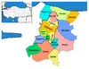 | ||||||||||||||||||||||||||
|
Metropolitan municipalities are bolded. | |||||||||||||||||||||||||||