
Northeastern Connecticut Planning Region | |
|---|---|
Planning region | |
| Northeastern Connecticut Council of Governments (NECCOG) | |
     From top left: Roseland Cottage in Woodstock, Pine Acres Lake along the Natchaug Trail, Thompson Common, Prudence Crandall Museum in Canterbury, Putnam District (village) | |
|
Logo | |
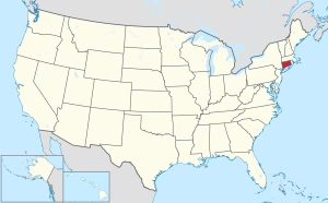
 Location within the U.S. state of Connecticut | |
 Connecticut's location within the U.S. | |
| Coordinates: 41°47′N 71°56′W / 41.78°N 71.94°W | |
| Country | |
| State | |
| Founded | 2013 |
| Largest town | Killingly |
| Government | |
| • Executive director | John Filchak |
| Area | |
| • Total | 553.9 sq mi (1,435 km2) |
| Population (2020) | |
| • Total | 95,348 |
| Time zone | UTC−5 (Eastern) |
| • Summer (DST) | UTC−4 (EDT) |
| Congressional district | 2nd |
| Website | neccog |

Interactive map of the Northeastern Connecticut Planning Region
The Northeastern Connecticut Planning Region is a planning region and county-equivalent in Connecticut. It is served by the coterminous Northeastern Connecticut Council of Governments (NECCOG). In 2022, planning regions were approved to replace Connecticut's counties as county-equivalents for statistical purposes, with full implementation occurring by 2024.[1][2]
YouTube Encyclopedic
-
1/3Views:8501 491157 241
-
A Place to Grow: Affordable Farming in Connecticut
-
Connecticut’s Climate for 2050 | UConn
-
Grow a Winter Garden: Everyone Can Grow a Garden (2019) #25
Transcription
Demographics
| Census | Pop. | Note | %± |
|---|---|---|---|
| 2020 | 95,348 | — | |
| 2022 (est.) | 96,196 | [3] | 0.9% |
| U.S. Decennial Census[2] | |||
As of the 2020 United States census, there were 95,348 people living in the Northeastern Connecticut Planning Region.[2]
Municipalities
The following municipalities are members of the Northeastern Connecticut Planning Region:[4]
Towns
- Ashford
- Brooklyn
- Canterbury
- Chaplin
- Eastford
- Hampton
- Killingly
- Plainfield
- Pomfret
- Putnam
- Scotland
- Sterling
- Thompson
- Union
- Voluntown
- Woodstock
References
- ^ "Governor Lamont Announces U.S. Census Bureau Approves Proposal for Connecticut's Planning Regions To Become County Equivalents". CT.gov. Retrieved March 24, 2023.
- ^ a b c "Change to County-Equivalents in the State of Connecticut". Federal Register. June 6, 2022. Retrieved March 24, 2023.
- ^ "U.S. Census Bureau QuickFacts: Northeastern Connecticut Planning Region, Connecticut; United States". www.census.gov. Retrieved May 13, 2023.
- ^ "Northeastern Connecticut Council of Governments". neccog.org. Retrieved March 24, 2023.
External links
Wikimedia Commons has media related to Northeastern Connecticut Planning Region, Connecticut.
Municipalities and communities of Northeastern Connecticut Planning Region, Connecticut, United States | ||
|---|---|---|
| Towns |  | |