
Simorgh County
Persian: شهرستان سیمرغ | |
|---|---|
 Location of Simorgh County in Mazandaran province (center right, pink) | |
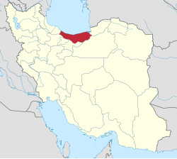 Location of Mazandaran province in Iran | |
| Coordinates: 36°35′00″N 52°49′45″E / 36.58333°N 52.82917°E[1] | |
| Country | Iran |
| Province | Mazandaran |
| Capital | Kiakola |
| Districts | Central, Talarpey |
| Population (2016)[2] | |
| • Total | 19,376 |
| Time zone | UTC+3:30 (IRST) |
Simorgh County (Persian: شهرستان سیمرغ) is in Mazandaran province, Iran. Its capital is the city of Kiakola.[3]
History
In January 2013, Kiakola District was separated from Qaem Shahr County in the establishment of Simorgh County, which was divided into two districts of two rural districts each, with Kiakola as its capital and only city.[3]
Demographics
Population
At the time of the 2016 National Census, the population was 19,376 in 6,636 households.[2]
Administrative divisions
Simorgh County's population and administrative structure are shown in the following table.
| Administrative Divisions | 2016[2] |
|---|---|
| Central District | 12,798 |
| Dasht-e Kenar RD | 2,107 |
| Kiakola RD | 2,651 |
| Kiakola (city) | 8,040 |
| Talarpey District | 6,578 |
| Talarpey RD | 3,920 |
| Tur RD | 2,658 |
| Total | 19,376 |
| RD = Rural District | |
See also
![]() Media related to Simorgh County at Wikimedia Commons
Media related to Simorgh County at Wikimedia Commons
References
- ^ OpenStreetMap contributors (16 March 2024). "Simorgh County" (Map). OpenStreetMap. Retrieved 16 March 2024.
- ^ a b c "Census of the Islamic Republic of Iran, 1395 (2016)". AMAR (in Persian). The Statistical Center of Iran. p. 02. Archived from the original (Excel) on 7 October 2021. Retrieved 19 December 2022.
- ^ a b Rahimi, Mohammadreza (23 January 2013). "With some changes in the map of country divisions: Simorgh County was created in Mazandaran province". DOLAT (in Persian). Ministry of Interior, Board of Ministers. Archived from the original on 21 April 2019. Retrieved 24 November 2023.
This Mazandaran province location article is a stub. You can help Wikipedia by expanding it. |