
Fereydunkenar County
Persian: شهرستان فریدونکنار | |
|---|---|
 Location of Fereydunkenar County in Mazandaran province (top center, pink) | |
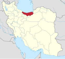 Location of Mazandaran province in Iran | |
| Coordinates: 36°39′N 52°31′E / 36.650°N 52.517°E[1] | |
| Country | |
| Province | Mazandaran |
| Capital | Fereydunkenar |
| Districts | Central, Dehferi |
| Population (2016)[2] | |
| • Total | 60,031 |
| Time zone | UTC+3:30 (IRST) |
Fereydunkenar County (Persian: شهرستان فریدونکنار) is in Mazandaran province, Iran. Its capital is the city of Fereydunkenar.[3]
History
After the National Census of 2006, Fereydunkenar District was separated from Babolsar County in the establishment of Fereydunkenar County, which was divided into two districts of two rural districts each, with Fereydunkenar as its capital and only city.[3]
Demographics
Population
The census in 2011 counted 57,980 people in 17,574 households.[4] At the 2016 census, the county's population was 60,031 in 20,066 households.[2]
Administrative divisions
Fereydunkenar County's population history and administrative structure over two consecutive censuses are shown in the following table.
| Administrative Divisions | 2011[4] | 2016[2] |
|---|---|---|
| Central District | 44,814 | 46,703 |
| Barik Rud-e Jonubi RD | 4,708 | 4,558 |
| Barik Rud-e Shomali RD | 3,914 | 3,991 |
| Fereydunkenar (city) | 36,192 | 38,154 |
| Dehferi District | 13,166 | 13,328 |
| Emamzadeh Abdollah-ye Jonubi RD | 6,566 | 6,568 |
| Emamzadeh Abdollah-ye Shomali RD | 6,600 | 6,760 |
| Total | 57,980 | 60,031 |
| RD = Rural District | ||
See also
![]() Media related to Fereydunkenar County at Wikimedia Commons
Media related to Fereydunkenar County at Wikimedia Commons
References
- ^ OpenStreetMap contributors (24 May 2023). "Fereydunkenar County" (Map). OpenStreetMap. Retrieved 24 May 2023.
- ^ a b c "Census of the Islamic Republic of Iran, 1395 (2016)". AMAR (in Persian). The Statistical Center of Iran. p. 02. Archived from the original (Excel) on 7 October 2021. Retrieved 19 December 2022.
- ^ a b Davodi, Parviz (29 July 1386). "Approval letter regarding the reforms of country divisions in Mazandaran province". Lamtakam (in Persian). Ministry of Interior, Political-Defense Commission of the Government Board. Archived from the original on 16 January 2024. Retrieved 16 January 2024.
- ^ a b "Census of the Islamic Republic of Iran, 1390 (2011)". Syracuse University (in Persian). The Statistical Center of Iran. p. 02. Archived from the original (Excel) on 19 January 2023. Retrieved 19 December 2022.
| Capital | |||||||||||||||||
|---|---|---|---|---|---|---|---|---|---|---|---|---|---|---|---|---|---|
| Districts |
| ||||||||||||||||
This Mazandaran province location article is a stub. You can help Wikipedia by expanding it. |