
Tonekabon County
Persian: شهرستان تنکابن | |
|---|---|
County | |
 Location of Tonekabon County in Mazandaran province (left, green) | |
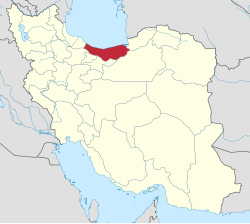 Location of Mazandaran province in Iran | |
| Coordinates: 36°35′N 50°50′E / 36.583°N 50.833°E[1] | |
| Country | |
| Province | Mazandaran |
| Capital | Tonekabon |
| Districts | Central, Khorramabad, Kuhestan, Nashta |
| Population (2016)[2] | |
| • Total | 166,132 |
| Time zone | UTC+3:30 (IRST) |
| Tonekabon County can be found at GEOnet Names Server, at this link, by opening the Advanced Search box, entering "9207240" in the "Unique Feature Id" form, and clicking on "Search Database". | |
Tonekabon County (Persian: شهرستان تنکابن) is in Mazandaran province, Iran. Its capital is the city of Tonekabon.[3]
At the 2006 census, the county's population was 193,428 in 55,318 households.[4] The following census in 2011 counted 153,940 people in 48,845 households,[5] by which time Abbasabad District had been separated from the county in the establishment of Abbasabad County.[6] At the 2016 census, Tonekabon County's population was 166,132 in 56,636 households.[2]
Administrative divisions
The population history and structural changes of Tonekabon County's administrative divisions over three consecutive censuses are shown in the following table. The latest census shows three districts, seven rural districts, and four cities.[2]
In 2019, Baladeh-ye Sharqi Rural District was established in Khorramabad District. Do Hezar Rural District and Seh Hezar Rural District were separated from that district in the establishment of Kuhestan District, which was divided into three rural districts and no cities.[7]
| Administrative Divisions | 2006[4] | 2011[5] | 2016[2] |
|---|---|---|---|
| Central District | 85,739 | 88,947 | 99,190 |
| Goli Jan RD | 34,341 | 24,342 | 23,643 |
| Mir Shams ol Din RD | 8,270 | 8,838 | 8,736 |
| Shirud (city) | 10,429 | 11,377 | |
| Tonekabon (city) | 43,128 | 45,338 | 55,434 |
| Abbasabad District1 | 45,589 | ||
| Kelarabad RD | 8,445 | ||
| Langarud RD | 10,839 | ||
| Abbasabad (city) | 11,256 | ||
| Kelarabad (city) | 5,457 | ||
| Salman Shahr (city) | 9,592 | ||
| Khorramabad District | 37,517 | 40,263 | 41,006 |
| Baladeh RD | 25,099 | 26,330 | 25,830 |
| Baladeh-ye Sharqi RD2 | |||
| Do Hezar RD | 1,494 | 2,789 | 2,326 |
| Seh Hezar RD | 988 | 2,030 | 1,308 |
| Khorramabad (city) | 9,936 | 9,114 | 11,542 |
| Kuhestan District2 | |||
| Do Hezar RD | |||
| Miyandaman RD2 | |||
| Seh Hezar RD | |||
| Nashta District | 24,583 | 24,730 | 25,935 |
| Katra RD | 8,032 | 8,140 | 8,147 |
| Tameshkol RD | 10,714 | 10,948 | 11,394 |
| Nashtarud (city) | 5,837 | 5,642 | 6,394 |
| Total | 193,428 | 153,940 | 166,132 |
| RD: Rural District 1Became a part of Abbasabad County[6] 2Established after the 2016 census[7] | |||
References
- ^ OpenStreetMap contributors (31 May 2023). "Tonekabon County" (Map). OpenStreetMap. Retrieved 31 May 2023.
- ^ a b c d "Census of the Islamic Republic of Iran, 1395 (2016)". AMAR (in Persian). The Statistical Center of Iran. p. 02. Archived from the original (Excel) on 7 October 2021. Retrieved 19 December 2022.
- ^ Habibi, Hassan (21 June 1369). "Approval of the organization and chain of citizenship of the elements and units of the divisions of Mazandaran province, centered in Sari city". Lamtakam (in Persian). Ministry of Interior, Defense Political Commission of the Government Council. Archived from the original on 14 January 2024. Retrieved 14 January 2024.
- ^ a b "Census of the Islamic Republic of Iran, 1385 (2006)". AMAR (in Persian). The Statistical Center of Iran. p. 02. Archived from the original (Excel) on 20 September 2011. Retrieved 25 September 2022.
- ^ a b "Census of the Islamic Republic of Iran, 1390 (2011)". Syracuse University (in Persian). The Statistical Center of Iran. p. 02. Archived from the original (Excel) on 19 January 2023. Retrieved 19 December 2022.
- ^ a b Davoodi, Parviz (3 March 2018). "Divisional reforms and changes in Mazandaran province". Qavanin (in Persian). Ministry of Interior, Cabinet of Ministers. Archived from the original on 20 May 2023. Retrieved 20 May 2023.
- ^ a b Jahangiri, Ishaq (23 January 2019). "Approval letter regarding country divisions in Tonekabon County of Mazandaran province". RC Majlis (Islamic Parliament Research Center of the Islamic Republic of Iran) (in Persian). Ministry of Interior, Council of Ministers. Archived from the original on 12 January 2021. Retrieved 31 May 2023.
This Mazandaran location article is a stub. You can help Wikipedia by expanding it. |