
Neka County
Persian: شهرستان نکا | |
|---|---|
County | |
 Location of Neka County in Mazandaran province (right, green) | |
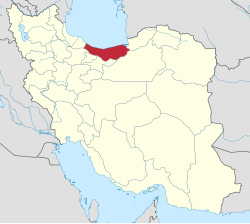 Location of Mazandaran province in Iran | |
| Coordinates: 36°34′30″N 53°37′00″E / 36.57500°N 53.61667°E[1] | |
| Country | |
| Province | Mazandaran |
| Capital | Neka |
| Districts | Central, Hezarjarib |
| Area | |
| • Total | 1,358.80 km2 (524.64 sq mi) |
| Population (2016)[3] | |
| • Total | 119,511 |
| • Density | 88/km2 (230/sq mi) |
| Time zone | UTC+3:30 (IRST) |
| Neka County can be found at GEOnet Names Server, at this link, by opening the Advanced Search box, entering "9207266" in the "Unique Feature Id" form, and clicking on "Search Database". | |
Neka County (Persian: شهرستان نکا) is in Mazandaran province, Iran. Its capital is the city of Neka.[4]
At the 2006 census, the county's population was 104,753 in 26,723 households.[5] The following census in 2011 counted 111,944 people in 32,613 households.[6] At the 2016 census, the county's population was 119,511 in 38,178 households.[3]
Administrative divisions
The population history of Neka County's administrative divisions over three consecutive censuses is shown in the following table. The latest census shows two districts, five rural districts, and one city.[3]
| Administrative Divisions | 2006[5] | 2011[6] | 2016[3] |
|---|---|---|---|
| Central District | 90,588 | 96,238 | 106,106 |
| Mehravan Rural District | 10,884 | 10,793 | 10,576 |
| Peyrajeh Rural District | 11,805 | 13,584 | 13,029 |
| Qareh Toghan Rural District | 21,747 | 21,181 | 21,510 |
| Neka (city) | 46,152 | 50,680 | 60,991 |
| Hezarjarib District | 14,165 | 15,706 | 13,405 |
| Estakhr-e Posht Rural District | 5,277 | 6,489 | 5,035 |
| Zarem Rud Rural District | 8,888 | 9,217 | 8,370 |
| Total | 104,753 | 111,944 | 119,511 |
Wikimedia Commons has media related to Neka County.
References
- ^ OpenStreetMap contributors (26 May 2023). "Neka County" (Map). OpenStreetMap. Retrieved 26 May 2023.
- ^ Management and Planning Organization of Mazandaran, 2006 [1]
- ^ a b c d "Census of the Islamic Republic of Iran, 1395 (2016)". AMAR (in Persian). The Statistical Center of Iran. p. 02. Archived from the original (Excel) on 7 October 2021. Retrieved 19 December 2022.
- ^ Habibi, Hassan. "Divisional changes in Mazandaran province". Lamtakam (in Persian). Ministry of Interior, Political and Defense Commission of the Government Council. Archived from the original on 15 January 2024. Retrieved 15 January 2024.
- ^ a b "Census of the Islamic Republic of Iran, 1385 (2006)". AMAR (in Persian). The Statistical Center of Iran. p. 02. Archived from the original (Excel) on 20 September 2011. Retrieved 25 September 2022.
- ^ a b "Census of the Islamic Republic of Iran, 1390 (2011)". Syracuse University (in Persian). The Statistical Center of Iran. p. 02. Archived from the original (Excel) on 19 January 2023. Retrieved 19 December 2022.
This Mazandaran location article is a stub. You can help Wikipedia by expanding it. |