
Palmetto Estates, Florida | |
|---|---|
 | |
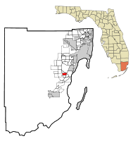 Location in Miami-Dade County and the state of Florida | |
 U.S. Census Bureau map showing CDP boundaries | |
| Coordinates: 25°37′11″N 80°21′42″W / 25.61972°N 80.36167°W | |
| Country | |
| State | |
| County | |
| Area | |
| • Total | 2.21 sq mi (5.71 km2) |
| • Land | 2.16 sq mi (5.59 km2) |
| • Water | 0.05 sq mi (0.12 km2) |
| Elevation | 10 ft (3 m) |
| Population | |
| • Total | 13,498 |
| • Density | 6,254.87/sq mi (2,414.69/km2) |
| Time zone | UTC-5 (Eastern (EST)) |
| • Summer (DST) | UTC-4 (EDT) |
| ZIP Code | 33157 (Miami) |
| Area code(s) | 305, 786, 645 |
| FIPS code | 12-54300[3] |
| GNIS feature ID | 1867184[4] |
Palmetto Estates is an unincorporated area and census-designated place (CDP) in Miami-Dade County, Florida, United States. It is part of the Miami metropolitan area of South Florida. The population was 13,498 at the 2020 census.[2]
YouTube Encyclopedic
-
1/5Views:1 0421 1101 444 19118 309496
-
Palmetto Bay, FL @ Tuscany Estates Gated Community
-
Palmetto Bay, Florida - Deering Estate (2019)
-
10 Places in Florida You Should NEVER Move To
-
Palmetto and Bradenton Florida - 20 Minute Travelogue
-
Palmetto Bay, FL @ Cutler Oaks Community
Transcription
Geography
Palmetto Estates is located 15 miles (24 km) southwest of downtown Miami at 25°37′11″N 80°21′42″W / 25.61972°N 80.36167°W (25.619782, -80.361752).[5] It is bordered to the east by the village of Palmetto Bay. It is otherwise bordered by unincorporated communities: Kendal and Richmond Heights to the north, and West Perrine to the south. The western border is the Homestead Extension of Florida's Turnpike. U.S. Route 1 (Dixie Highway) runs along the eastern border.
According to the United States Census Bureau, the CDP has a total area of 8.44 square miles (21.9 km2), of which 8.29 square miles (21.5 km2) are land and 0.16 square miles (0.41 km2), or 1.89%, are water.[1]
Demographics
| Census | Pop. | Note | %± |
|---|---|---|---|
| 1980 | 11,116 | — | |
| 1990 | 12,293 | 10.6% | |
| 2000 | 13,675 | 11.2% | |
| 2010 | 13,535 | −1.0% | |
| 2020 | 13,498 | −0.3% | |
| source:[6] | |||
2010 and 2020 census
| Race | Pop 2010[7] | Pop 2020[8] | % 2010 | % 2020 |
|---|---|---|---|---|
| White (NH) | 1,546 | 1,206 | 11.42% | 8.93% |
| Black or African American (NH) | 5,308 | 3,873 | 39.22% | 28.69% |
| Native American or Alaska Native (NH) | 10 | 17 | 0.07% | 0.13% |
| Asian (NH) | 444 | 326 | 3.28% | 2.42% |
| Pacific Islander or Native Hawaiian (NH) | 7 | 1 | 0.05% | 0.01% |
| Some other race (NH) | 74 | 152 | 0.55% | 1.13% |
| Two or more races/Multiracial (NH) | 306 | 338 | 2.26% | 2.50% |
| Hispanic or Latino (any race) | 5,840 | 7,585 | 43.15% | 56.19% |
| Total | 13,535 | 13,498 | 100.00% | 100.00% |
As of the 2020 United States census, there were 13,498 people, 3,854 households, and 3,233 families residing in the CDP.[9]
As of the 2010 United States census, there were 13,535 people, 3,918 households, and 3,195 families residing in the CDP.[10]
2000 census
As of the census[3] of 2000, there were 13,675 people, 4,054 households, and 3,344 families residing in the CDP. The population density was 6,437.3 inhabitants per square mile (2,485.5/km2). There were 4,187 housing units at an average density of 1,971.0 per square mile (761.0/km2). The racial makeup of the CDP was 37.68% White (16.9% were Non-Hispanic White),[11] 48.77% African American, 0.21% Native American, 3.06% Asian, 0.01% Pacific Islander, 4.82% from other races, and 5.44% from two or more races. Hispanic or Latino of any race were 28.91% of the population.
As of 2000, there were 4,054 households, out of which 45.8% had children under the age of 18 living with them, 55.9% were married couples living together, 20.7% had a female householder with no husband present, and 17.5% were non-families. 13.7% of all households were made up of individuals, and 3.5% had someone living alone who was 65 years of age or older. The average household size was 3.35 and the average family size was 3.66.
In 2000, in the CDP, the population was spread out, with 31.2% under the age of 18, 9.1% from 18 to 24, 30.2% from 25 to 44, 22.1% from 45 to 64, and 7.5% who were 65 years of age or older. The median age was 33 years. For every 100 females, there were 92.6 males. For every 100 females age 18 and over, there were 88.8 males.
In 2000, the median income for a household in the CDP was $48,338, and the median income for a family was $49,565. Males had a median income of $31,440 versus $26,921 for females. The per capita income for the CDP was $16,701. About 7.8% of families and 10.9% of the population were below the poverty line, including 13.3% of those under age 18 and 11.7% of those age 65 or over.
As of 2000, speakers of English as a first language accounted for 65.94% of residents, while Spanish made up 29.75%, French Creole was at 2.08%, and French was the mother tongue of 0.88% of the population.[12]
References
- ^ a b "2022 U.S. Gazetteer Files: Florida". United States Census Bureau. Retrieved January 11, 2023.
- ^ a b "P1. Race – Palmetto Estates CDP, Florida: 2020 DEC Redistricting Data (PL 94-171)". U.S. Census Bureau. Retrieved January 11, 2023.
- ^ a b "U.S. Census website". United States Census Bureau. Retrieved January 31, 2008.
- ^ "US Board on Geographic Names". United States Geological Survey. October 25, 2007. Retrieved January 31, 2008.
- ^ "US Gazetteer files: 2010, 2000, and 1990". United States Census Bureau. February 12, 2011. Retrieved April 23, 2011.
- ^ "CENSUS OF POPULATION AND HOUSING (1790-2000)". U.S. Census Bureau. Retrieved July 17, 2010.
- ^ "P2 HISPANIC OR LATINO, AND NOT HISPANIC OR LATINO BY RACE - 2010: DEC Redistricting Data (PL 94-171) - Palmetto Estates CDP, Florida". United States Census Bureau.
- ^ "P2 HISPANIC OR LATINO, AND NOT HISPANIC OR LATINO BY RACE - 2020: DEC Redistricting Data (PL 94-171) - Palmetto Estates CDP, Florida". United States Census Bureau.
- ^ "S1101 HOUSEHOLDS AND FAMILIES - 2020: Palmetto Estates CDP, Florida". United States Census Bureau.
- ^ "S1101 HOUSEHOLDS AND FAMILIES - 2010: Palmetto Estates CDP, Florida". United States Census Bureau.
- ^ "Demographics of Palmetto Estates, FL". MuniNetGuide.com. Retrieved November 7, 2007.
- ^ "MLA Data Center Results of Palmetto Estates, FL". Modern Language Association. Retrieved November 7, 2007.
Municipalities and communities of Miami-Dade County, Florida, United States | ||
|---|---|---|
| Cities |  | |
| Towns | ||
| Villages | ||
| CDPs |
| |
| Unincorporated communities | ||
| Ghost town | ||
| Indian reservation | ||
| Footnotes | ‡This populated place also has portions in an adjacent county or counties | |