
Namutumba District | |
|---|---|
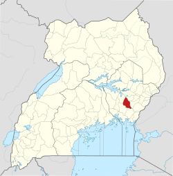 District location in Uganda | |
| Coordinates: 00°21′N 33°03′E / 0.350°N 33.050°E | |
| Country | |
| Region | Eastern Uganda |
| Sub-region | Busoga sub-region |
| Capital | Namutumba |
| Area | |
| • Land | 814.3 km2 (314.4 sq mi) |
| Population (2012 Estimate) | |
| • Total | 218,900 |
| • Density | 268.8/km2 (696/sq mi) |
| Time zone | UTC+3 (EAT) |
| Website | www |
Namutumba District, sometimes referred to as Busiki District[1] is a district in Eastern Uganda. It is named after its 'chief town', Namutumba, where the district headquarters are located.
YouTube Encyclopedic
-
1/1Views:1 045
-
visit to Namutumba town busoga uganda
Transcription
Location
Namutumba District is bordered by Pallisa District to the north, Kibuku District to the northeast, Butaleja District to the southeast, Bugiri District to the south, Iganga District to the southwest and Kaliro District to the northwest.[2] The district headquarters at Namutumba are located approximately 90 kilometres (56 mi), by road, northeast of Jinja, the largest city in the sub-region.[3] The coordinates of the district are:00 51N, 33 41E.
Overview
Namutumba District was created by an Act of the Ugandan Parliament in 2005 and became operational on 1 July 2006. The district was previously part of Iganga District and was known as Busiki County. Namutumba District is part of Busoga sub-region. The districts that constitute the sub-region include the following: 1. Bugiri District 2. Buyende District 3. Bugweri District 4. Iganga District 5. Jinja District 6. Kaliro District 7. Kamuli District 8. Luuka District 9. Mayuge District 10. Namayingo District and 11. Namutumba District
According to the 2002 national census, the Busoga sub-region was home to an estimated 2.5 million people.[4] Namutumba District is divided into the following sub-counties and one town council:
- Bulange
- Ivukula
- Kibaale
- Magada
- Namutumba
- Nsinze
- Namutumba TC
Population
In 1991, the national population census estimated the district population at about 123,900. The national census in 2002 estimated the population of the district at about 167,700. The annual population growth rate in the district was calculated at 2.7%. It is estimated that the population of Namutumba District in 2012 was approximately 218,900.[5]
Economic activities
Subsistence agriculture and animal husbandry are the two main economic activities in the district.
See also
References
- ^ ISO 3166-2 newsletter Date: 2007-11-28
- ^ Uganda District Map
- ^ "Map Showing Jinja And Namutumba With Distance Marker". Globefeed.com. Retrieved 20 May 2014.
- ^ Estimated Population of Busoga Sub-region In 2002
- ^ "Estimated Population of Namutumba District In 1991, 2002 & 2012". Citypopulation.de. Retrieved 20 May 2014.