
Yumbe District | |
|---|---|
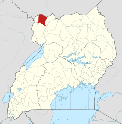 District location in Uganda | |
| Coordinates: 03°28′N 31°15′E / 3.467°N 31.250°E | |
| Country | |
| Region | Northern Uganda |
| Sub-region | West Nile sub-region |
| Capital | Yumbe |
| Area | |
| • Total | 2,393 km2 (924 sq mi) |
| Population (2012 Estimate) | |
| • Total | 545,500 |
| • Density | 228/km2 (590/sq mi) |
| Time zone | UTC+3 (EAT) |
| Website | web |
Yumbe District is a district in Northern Region, Uganda. Like most other Ugandan districts, it is named after its 'chief town', Yumbe, where the district headquarters are located.
YouTube Encyclopedic
-
1/2Views:572381
-
Pojulu Cultural Dance in Yumbe District in 2017
-
Pojulu Cultural Dance in Northern Uganda in 2017
Transcription
Location
Yumbe District is one of Uganda's most northern districts. The district is bordered by South Sudan to the north, Moyo District to the east, Adjumani District to the southeast, Arua District to the south, Maracha District to the southwest and Koboko District to the west.[1] The district headquarters at Yumbe are located approximately 75 kilometres (47 mi), by road, north of Arua, the largest town in the sub-region.[2] The coordinates of the district are:03 28N, 31 15E.
Overview
Yumbe District was established in 2006 when Aringa County was split off Arua District and renamed Yumbe District.The people in the district are still suffering from the effects of the civil war, which lasted about twenty years (1980–2000). The peace agreement between UNRF2 and the Government of Uganda was signed in the year 2000 in Yumbe.
The majority (89%) ethnicity in the district are the Aringa people. Other ethnicities include the Kakwa, Madi and the Alur. The Acholi are scattered along River Nile and mainly engage in fishing and hunting, along the river. They account for about 2% of the district's population.
The languages spoken in the district include: the Aringa language (majority), Kakwa language, Madi language and the Alur language. The second most-spoken language however is Kiswahili. In the urban areas, one might encounter individuals who can understand Arabic or English.
Population
Yumbe is the only district in the country with a mainly Muslim majority population (76%),[3] which is a big exception for Uganda, where 85% of the population is Christians.[4] The fertility rate in the district is high (7.5).[5]
In 1991, the national population census estimated the district population at about 99,800. The 2002 national census estimated the population of the district at about 251,800 inhabitants. The annual population growth rate in Yumbe District was calculated at 8.2%. It was estimated that the population of Yumbe District in 2012 was approximately 545,500.[6]
Economic activities
Subsistence agriculture is the main economic activity in the district, as is the case with most Ugandan districts. Crops grown include the following:[7]
See also
References
- ^ Uganda District Map
- ^ "Map Showing Arua And Yumbe With Distance Marker". Globefeed.com. Retrieved 22 May 2014.
- ^ "Self-Reported Religious Affiliations of Ugandans In 2002, By District" (PDF). Uganda Bureau of Statistics. 2002. Retrieved 22 May 2014.
- ^ Census 2014 Final Results
- ^ "Population Dynamics of Ugandans In 2002, By District" (PDF). Uganda Bureau of Statistics. Retrieved 22 May 2014.
- ^ "Estimated Population of Yumbe District In 1991, 2002 & 2012". Citypopulation.de. Retrieved 22 May 2014.
- ^ "Profile of Yumbe District". Uganda Travel Guide. Retrieved 22 May 2014.