
Gomba District | |
|---|---|
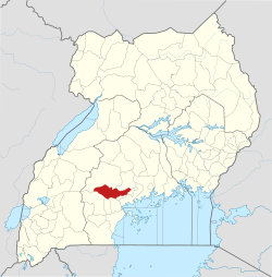 District location in Uganda | |
| Coordinates: 00°11′S 31°55′E / 0.183°S 31.917°E | |
| Country | |
| Region | Central Uganda |
| Capital | Kanoni |
| Area | |
| • Land | 1,679.3 km2 (648.4 sq mi) |
| Population (2012 Estimate) | |
| • Total | 152,800 |
| • Density | 91/km2 (240/sq mi) |
| Time zone | UTC+3 (EAT) |
| Website | www |
Gomba is a district in Central Uganda.
Location
Gomba District is bordered by Mubende District to the west and north, Mityana District to the northeast and Butambala District to the east. Kalungu District, Bukomansimbi District and Sembabule District lie to the south of Gomba District. Kanoni, where the district headquarters are located, lies approximately 97 kilometres (60 mi), by road, southwest of Kampala, the capital of Uganda and the largest city in that country.[1] This location is approximately 60 kilometres (37 mi), by road, west of Mpigi, the nearest large metropolitan area.[2] The coordinates of the district are:00 11N, 31 55E. (Latitude:0.1750; Longitude:31.9100).
Overview
Gomba District was created in 2010 by Act of Parliament, when Mpigi District was split into three: (a) Gomba District, (b) Butambala District and (c) Mpigi District. The town of Kanoni was selected to be the district headquarters. The district became operational on 1 July 2010. Generally, Gomba District is a rural district which receives lower precipitation than the districts of Butambala and Mpigi. Livestock farming is a major economic activity in the district supplemented with subsistence agriculture.[3]
Population
In 1991, the national population census estimated the district population at about 119,550. The next census in 2002 estimated the population of Gomba District at approximately 133,300. In 2012, the estimated population in the district was about 152,800.[4]
See also
References
- ^ "Road Distance Between Kampala And Kanoni With Map". Globefeed.com. Retrieved 14 May 2014.
- ^ "Map Showing Mpigi And Kanoni With Distance Marker". Globefeed.com. Retrieved 14 May 2014.
- ^ Kimbowa, Joseph (22 March 2013). "Uganda: Gomba – Delight Turns to Despair". The Observer (Uganda) via AllAfrica.com. Retrieved 14 May 2014.
- ^ "Estimated Population of Gomba District In 1991, 2002 & 2012". Citypopulation.de. Retrieved 14 May 2014.