
Wakiso District | |
|---|---|
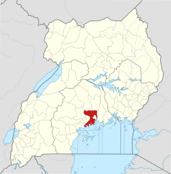 District location in Uganda | |
| Coordinates: 00°24′N 32°29′E / 0.400°N 32.483°E | |
| Country | |
| Region | Central Uganda |
| Capital | Wakiso |
| Area | |
| • Total | 1,906.7 km2 (736.2 sq mi) |
| • Land | 1,906.7 km2 (736.2 sq mi) |
| Elevation | 1,200 m (3,900 ft) |
| Population (2020 Estimate) | |
| • Total | 2,915,200 |
| • Density | 1,500/km2 (4,000/sq mi) |
| [1] | |
| Time zone | UTC+3 (EAT) |
| Website | www |
Wakiso District is a district in the Central Region of Uganda that partly encircles Kampala, Uganda's capital city. The town of Wakiso is the site of the district headquarters. Kira, the country's second largest city and suburb of Kampala, is in the district.
YouTube Encyclopedic
-
1/1Views:1 000
-
Wakiso District
Transcription
Location
Wakiso District lies in the Central Region of the country, bordering Nakaseke District and Luweero District to the north, Mukono District to the east, Kalangala District in Lake Victoria to the south, Mpigi District to the southwest and Mityana District to the northwest.[2] Wakiso, where the district headquarters are located, lies approximately 20 kilometres (12 mi) northwest of Kampala, the capital of Uganda and the largest city in the country.[3] The coordinates of the district are:00 24N, 32 29E.
Demographics
In 1991, the national population census estimated the district population at 562,887. According to the 2002 national census figures, Wakiso District had a population of 907,988, making it the second-most populated district in the country. At that time, 53 percent of the population were children below the age of 18 years and 17 percent of the population were orphans. The national census and household survey of 2014 enumerated 1,997,418 people in the district. The Uganda Bureau of Statistics (UBOS), estimated the total population in the district, as of mid-year 2020 at 2,915,000. UBOS also calculated that the district population increased at an average annual rate of 6.7 percent, between 2014 and 2020.[1]
| Year | Pop. | ±% |
|---|---|---|
| 1991 | 562,887 | — |
| 2002 | 907,988 | +61.3% |
| 2014 | 1,997,418 | +120.0% |
| 2020 | 2,915,200 | +45.9% |
| source:[1] | ||
Administrative units

Wakiso District is made up of two counties and a municipality: Kyadondo County, Busiro County. Entebbe City was split off and granted city status in 2020. The district is further subdivided into the following administrative units:[4]
- Busukuma
- Gombe
- Kakiri Town
- Katabi
- Kasanje
- Kira Town
- Ssabagabo
- Masuliita
- Nabweru
- Namayumba
- Nangabo (includes Gayaza and Kasangati)
- Nansana Town
- Nsangi
- Ssisa
- Wakiso Town
The district headquarters are located in Wakiso Town, approximately 20 kilometres (12 mi) northwest of Kampala on the highway to Hoima.[5] Wakiso District has a total area of 2,704 square kilometres (1,044 sq mi).
District leadership
The leadership is entrusted in the District Executive Council, composed of:
- District Chairman
- District Vice Chairman
- District Secretary for Finance
- District Secretary for Production & Natural Resources
- District Secretary for Works & Technical Services
- District secretary Gender
- Resident District Commissioner
- Deputy Resident District Commissioner
Tourist attractions
The tourist attractions in the district include:
- Buganda Cultural Sites and Kabaka's Palaces
- Old Entebbe Town
- Entebbe Botanical Gardens[6]
- Uganda Wildlife Education Center (UWEC) - Entebbe[7]
- Entebbe International Airport
- State House - Entebbe (the Official Residence of the President of Uganda)
- Ngamba Island Chimpanzee Sanctuary on Lake Victoria - Sanctuary for chimpanzees
- Bulago Resort Island
- Lake Victoria - the largest lake in Africa and the second largest fresh-water lake in the world[8]
- Uganda Martyrs Basilica - Namugongo
- Mandela National Stadium - Namboole
See also
References
- ^ a b c Uganda Bureau of Statistics (12 June 2020). "The population development of Wakiso District as well as related information and services" (Citypopulation.de Quoting Uganda Bureau of Statistics). Citypopulation.de. Retrieved 11 March 2022.
- ^ Uganda District Map
- ^ "Road Distance Between Kampala And Wakiso With Map". Globefeed.com. Retrieved 14 April 2014.
- ^ "Sub-counties In Wakiso District". Land Conflict Mapping Tool (lcmt.com). Retrieved 14 April 2014.
- ^ Kato, Joshua (24 October 2007). "Challenges of Turning Wakiso". New Vision. Retrieved 14 April 2014.
- ^ "Botanical Gardens land is still intact, says NARO boss". Nile Post. November 19, 2019.
- ^ "Uganda Wildlife Education Center". uwec.ug.
- ^ "Lake Victoria | Size, Map, Countries, & Facts | Britannica". www.britannica.com. Retrieved 2022-06-28.
External links
- Wakiso District Profile at Ugandatravelguide.com
- Bulago Island Homepage Archived 2011-10-18 at the Wayback Machine
- Ngamba Island Homepage
- Google Map of the Wakiso District
| International | |
|---|---|
| National | |