
Dokolo District | |
|---|---|
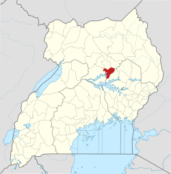 District location in Uganda | |
| Coordinates: 01°55′N 33°10′E / 1.917°N 33.167°E | |
| Country | |
| Region | Northern Region |
| Sub-region | Lango sub-region |
| Capital | Dokolo |
| Area | |
| • Total | 1,072.8 km2 (414.2 sq mi) |
| Population (2012 Estimate) | |
| • Total | 183,400 |
| • Density | 171/km2 (440/sq mi) |
| Time zone | UTC+3 (EAT) |
| Website | www |
Dokolo District is a district in the Northern Region of Uganda. The town of Dokolo is its main municipal, administrative, and commercial centre.
YouTube Encyclopedic
-
1/1Views:568
-
The Journey Of Hon. Cecelia Atim Ogwal | Woman MP - Dokolo District. Transformed Lives
Transcription
Location
Dokolo District is bordered by Lira District to the northwest, Alebtong District to the northeast, Kaberamaido District to the east and south, Amolatar District to the southwest, and Apac District to the west. The administrative headquarters of the district are located approximately 60 kilometres (37 mi), by road, southeast of Lira, the largest city in the sub-region.[1] The coordinates of the district are 01 55N, 33 10E.[2]
Overview
Dokolo District was established by the Ugandan parliament in 2005.[3] It became operational on 1 July 2006.[3] Before that, Dokolo was a county in Lira District. It is part of the larger Lango sub-region, home to an estimated 2.13 million Langi people according to the 2014 national census.[4] The district is a predominantly rural district.[4]
Population
The 1991 census estimated the population of the district at 85,000. The 2002 national census estimated the population at 129,400. The district population grew at a calculated rate of 3.6 percent between 2002 and 2012. It has been estimated that the population of the district in 2012 was 183,400.[5]
See also
References
- ^ "Road Distance Between Lira And Dokolo With Map". Globefeed.com. Retrieved 25 May 2014.
- ^ "Subcounties in Dokolo District, Uganda". www.lcmt.org. Retrieved 2021-05-21.
- ^ a b Government of Uganda, Dokolo District. "Welcome to Dokolo District". Government of Uganda, Dokolo District. Retrieved 5 June 2021.
- ^ a b UBOS (2016). National Population and Housing Census 2014 (PDF). Online: UBOS. Retrieved 5 June 2021.
- ^ "Estimated Population of Dokolo District In 1991, 2002 & 2012". Citypopulation.de. Retrieved 25 May 2014.