
Eldorado, Texas | |
|---|---|
 Eldorado welcome sign | |
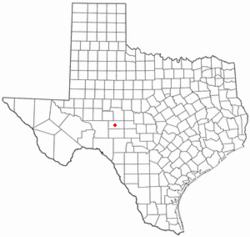 Location of Eldorado, Texas | |
 | |
| Coordinates: 30°51′39″N 100°35′54″W / 30.86083°N 100.59833°W | |
| Country | United States |
| State | Texas |
| County | Schleicher |
| Government | |
| • Type | Mayor–council |
| • Body | City Council |
| • Mayor | George Arispe |
| Area | |
| • Total | 1.39 sq mi (3.61 km2) |
| • Land | 1.39 sq mi (3.61 km2) |
| • Water | 0.00 sq mi (0.00 km2) |
| Elevation | 2,438 ft (743 m) |
| Population (2020) | |
| • Total | 1,574 |
| • Density | 1,100/sq mi (440/km2) |
| Time zone | UTC-6 (Central (CST)) |
| • Summer (DST) | UTC-5 (CDT) |
| ZIP code | 76936 |
| Area code | 325 |
| FIPS code | 48-22960[2] |
| GNIS feature ID | 1356891[3] |
| Website | http://www.eldoradotexas.us/ |
Eldorado (/ˌɛldəˈrɑːdoʊ/ EL-də-RAH-doh, /-ˈreɪdoʊ/ -RAY-doh) is the only city in and the county seat of Schleicher County, Texas, United States.[4] The population was 1,574 at the 2020 census.[5] Eldorado is located on U.S. Highway 277, some 21 miles (34 km) north of Sonora and 43 miles (69 km) south of San Angelo, Texas.
YouTube Encyclopedic
-
1/3Views:5429622 136
-
A Strange Sighting Near Eldorado Texas: What Is That Thing?
-
El Dorado Texas...going Prius camping
-
Eldorado Texas September 2007
Transcription
Geography
Eldorado is located at 30°51′39″N 100°35′54″W / 30.86083°N 100.59833°W (30.860746, −100.598329).[6]
According to the United States Census Bureau, the city has a total area of 1.4 square miles (3.6 km2), all land.
Demographics
2020 census
| Race | Number | Percentage |
|---|---|---|
| White (NH) | 480 | 30.5% |
| Black or African American (NH) | 15 | 0.95% |
| Native American or Alaska Native (NH) | 3 | 0.19% |
| Asian (NH) | 6 | 0.38% |
| Pacific Islander (NH) | 2 | 0.13% |
| Some Other Race (NH) | 6 | 0.38% |
| Mixed/Multi-Racial (NH) | 15 | 0.95% |
| Hispanic or Latino | 1,047 | 66.52% |
| Total | 1,574 |
As of the 2020 United States census, there were 1,574 people, 791 households, and 544 families residing in the city.
2000 census
| Census | Pop. | Note | %± |
|---|---|---|---|
| 1930 | 1,404 | — | |
| 1940 | 1,530 | 9.0% | |
| 1950 | 1,663 | 8.7% | |
| 1960 | 1,815 | 9.1% | |
| 1970 | 1,446 | −20.3% | |
| 1980 | 2,061 | 42.5% | |
| 1990 | 2,019 | −2.0% | |
| 2000 | 1,951 | −3.4% | |
| 2010 | 1,951 | 0.0% | |
| 2020 | 1,574 | −19.3% | |
| U.S. Decennial Census[9] | |||
As of the census[2] of 2000, 1,951 people, 712 households, and 513 families resided in the city. The population density was 1,408 inhabitants per square mile (544/km2). There were 838 housing units at an average density of 604.6 per square mile (233.4/km2). The racial makeup of the city was 70.63% White, 2.15% African American, 0.10% Native American, 0.26% Asian, 0.05% Pacific Islander, 24.24% from other races, and 2.56% from two or more races. Hispanics or Latinos of any race were 53.92% of the population.
Of the 712 households, 37.9% had children under the age of 18 living with them, 58.7% were married couples living together, 10.0% had a female householder with no husband present, and 27.9% were not families. About 26.3% of all households were made up of individuals, and 13.1% had someone living alone who was 65 years of age or older. The average household size was 2.67 and the average family size was 3.26.
In the city, the population was distributed as 30.4% under the age of 18, 7.7% from 18 to 24, 24.7% from 25 to 44, 21.3% from 45 to 64, and 16.0% who were 65 years of age or older. The median age was 36 years. For every 100 females, there were 96.9 males. For every 100 females age 18 and over, there were 89.4 males.
The median income for a household in the city was $27,682, and for a family was $30,781. Males had a median income of $26,172 versus $18,750 for females. The per capita income for the city was $12,994. About 20.8% of families and 26.1% of the population were below the poverty line, including 35.6% of those under age 18 and 26.2% of those age 65 or over.
Education
The City of Eldorado is served by the Schleicher County Independent School District.
At the end of the 2007–2008 school year, the state of Texas ruled Eldorado High School as "Academically Unacceptable".[10] However, in 2010 the school was determined to be "Academically Acceptable".
Yearning for Zion Ranch
Eldorado was the nearest city to the Yearning for Zion Ranch (YFZ Ranch), the headquarters of the Fundamentalist Church of Jesus Christ of Latter Day Saints headed by convicted sex offender felon Warren Jeffs. More than 400 children were removed from the compound in April 2008 by Texas Child Protective Services.[11] Hundreds of children were taken into custody and temporarily placed into foster homes. The children were returned to their mothers shortly afterward.[12] In 2018, the YFZ Ranch was sold off and closed.
Media portrayals
The movie El Dorado, starring John Wayne and Robert Mitchum, takes place in a fictional "El Dorado" during the late 1800s. The real town of Eldorado did not exist until 1895, well after the date of John Wayne's fictional adventure. Eldorado, and The Eldorado Success was shown in the 2022 Netflix documentary "Keep Sweet: Pray and Obey" about the FLDS community.
Gallery
 |
 |
 |
 |
See also
Notes
References
- ^ "2019 U.S. Gazetteer Files". United States Census Bureau. Retrieved August 7, 2020.
- ^ a b "U.S. Census website". United States Census Bureau. Retrieved January 31, 2008.
- ^ "US Board on Geographic Names". United States Geological Survey. October 25, 2007. Retrieved January 31, 2008.
- ^ "Find a County". National Association of Counties. Archived from the original on May 31, 2011. Retrieved June 7, 2011.
- ^ a b "Explore Census Data". data.census.gov. Retrieved May 19, 2022.
- ^ "US Gazetteer files: 2010, 2000, and 1990". United States Census Bureau. February 12, 2011. Retrieved April 23, 2011.
- ^ https://www.census.gov [not specific enough to verify]
- ^ "About the Hispanic Population and its Origin". www.census.gov. Retrieved May 18, 2022.
- ^ "Census of Population and Housing". Census.gov. Retrieved June 4, 2015.
- ^ "Districts and Campuses that have been Academically Unacceptable for One or More Consecutive Years" (PDF). Archived from the original (PDF) on August 21, 2008. Retrieved September 16, 2008.
- ^ "400 Kids Taken From Polygamist Compound". The Associated Press. April 7, 2008. Archived from the original on April 9, 2008. Retrieved April 7, 2008.
- ^ "Warrant dropped against man named in polygamist retreat raid". The Associated Press. May 3, 2008. Archived from the original on May 6, 2008. Retrieved May 3, 2008.
External links
- The Eldorado Success Newspaper – Official website
Municipalities and communities of Schleicher County, Texas, United States | ||
|---|---|---|
| City |  | |
| Unincorporated communities | ||
| International | |
|---|---|
| National | |
| Geographic | |
| Other | |