
| Artichoke River | |
|---|---|
 Lower Artichoke River | |
 Location of mouth in Massachusetts | |
| Location | |
| Country | US |
| Physical characteristics | |
| Source | |
| • location | West Newbury, Massachusetts |
| • elevation | 20 feet (6 m) at West Newbury, Massachusetts |
| Mouth | |
• location | Merrimack River |
| Length | 1.2 miles (2 km) |
| Basin size | 3.5 square miles (9.1 km2) |
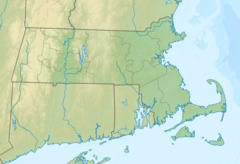
42°49′12″N 70°56′19″W / 42.82000°N 70.93861°W The Artichoke River (1.2 miles (1.9 km)long),[1] is a tributary of the Merrimack River in Massachusetts in the United States. It is in Essex County, Massachusetts, and flows generally north, marking the boundary between West Newbury and Newburyport. The Upper and Lower Artichoke reservoirs are impoundments of the river that acts as a water source for nearby towns. Despite the short length of the river, there are three dams along its course, the Emory Lane Dam, the Lower Artichoke Dam and the Upper Artichoke Dam.[1] The river is named for the Jerusalem Artichoke, which had been harvested nearby by Native Americans and early settlers.[2]
YouTube Encyclopedic
-
1/5Views:6 841 9652 644 103346589 125237 636
-
Bury An Egg In Your Garden Soil and What Happens A Few Days Later Will Surprise You
-
11 Gardening Hacks That Will Blow Your Mind Away
-
Lake Quannapowitt (Wakefield, Massachusetts)
-
36 Wild Edibles & Medicinal Plants In 15 Minutes
-
BEST TIPS for growing CANTALOUPE: Grow SWEET, FLAVORFUL cantaloupe with these tips.
Transcription
See also
References
- ^ a b accessed October 26, 2016[dead link]
- ^ Peter Muise (2011-11-29). "NEW ENGLAND FOLKLORE: Jerusalem Artichokes". Newenglandfolklore.blogspot.com. Retrieved 2016-10-27.