
Zermou | |
|---|---|
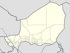 Zermou Location in Niger | |
| Coordinates: 13°42′40″N 9°09′20″E / 13.71111°N 9.15556°E | |
| Country | |
| Region | Zinder Region |
| Area | |
| • Total | 92.9 sq mi (240.5 km2) |
| Population (2012 census) | |
| • Total | 32,486 |
| • Density | 350/sq mi (140/km2) |
| Time zone | UTC+1 (WAT) |
Zermou is a town and rural commune in Niger.[1]
Geography
Zermou is located in the Sahel region. The average annual rainfall is around 350 millimeters.[2] Zermou's neighbouring municipalities are Mazamni to the north, Guidimouni to the east, Hamdara to the south-east, Mirriah to the south-west and Gaffati to the west. The settlements in the municipality include 85 villages, 27 hamlets and 4 camps. The main town of the rural municipality is the village of Zermou.[3]
History
Sultan Ibrahim dan Sélimane of Zinder, who ruled from 1822 to 1841 and from 1843 to 1850,[4] encouraged Tuareg from the Aïr to settle in his sultanate. He made land available to their enslaved farmers, the Ikelan, near the villages of Zermou, Baban Tapki, Dogo, Droum and Gouna.[5] At the end of the 19th century, the markets of Zermou and other villages in the region provided the important Zinder-based trader Malan Yaroh with the handicrafts, furs, animal skins and henna he needed for the trans-Saharan trade. The Zermou market was one of the small markets in the region that were authorised by the French administration at the beginning of the 20th century.[6] The British travel writer A. Henry Savage Landor visited the village in 1906 during his twelve-month crossing of Africa.[7]
The rural municipality of Zermou emerged from the canton of Zermou in 2002 as part of a nationwide administrative reform.
Demographics
In the 2012 census, the municipality had 32,486 inhabitants.[8] The village of Zermou had 3,212 inhabitants.[9] In ethnic terms, the municipality is a settlement area of Damagarawa and Ikelan. Most inhabitants speak the Hausa language. In addition, Fulbe, who practise nomadism and transhumance, move through the municipality with their herds of cattle.
| Census | Population |
|---|---|
| 2001 | 17,818 |
| 2012 | 32,486 |
Economy
The majority of the rural community consists of sandy soils on which millet is grown. The rockier parts of Zermous are used for grazing. The unfavourable soil conditions, combined with low rainfall, have led to recurring famines for generations.
References
- ^ Loi n° 2002-014 du 11 JUIN 2002 portant création des communes et fixant le nom de leurs chefs-lieux[permanent dead link]. Includes list of 213 communes rurales and seats, 52 Communes urbaines and seats
- ^ Mehdi Saqalli (2008), "Populations, Farming Systems and Social Transitions in Sahelian Niger. An Agent-based Modeling Approach" (PDF), mehdisaqalli.res-ear.ch (Thèse présentée en vue de l'obtention du grade de docteur en sciences agronomiques et ingénierie biologique), Löwen: Université catholique de Louvain, p. 46, retrieved 2022-04-14
- ^ Loi n° 2002-014 du 11 JUIN 2002 portant création des communes et fixant le nom de leurs chefs-lieux, République du Niger, 2002-06-11
- ^ Maurice Abadié (1927), "Annexe V: Généalogie des sultans de Damagaram", La Colonie du Niger (Mit einem Vorwort von Maurice Delafosse), Paris: Société d’Editions Géographiques, Maritimes et Coloniales
- ^ Roberta Ann Dunbar (1977), Suzanne Miers, Igor Kopytoff (ed.), "Slavery and the Evolution of Nineteenth-Century Damagaram (Zinder, Niger)", Slavery in Africa. Historical and Anthropological Perspectives, Madison/London: The University of Wisconsin Press, p. 167, ISBN 0-299-07330-0
- ^ Hassane Gandah Nabi (2013), Commerçants et entrepreneurs du Niger (1922–2006), Paris: L’Harmattan, p. 37, ISBN 978-2-336-29136-9
- ^ A. Henry Savage Landor (1907), Across Widest Africa. An Account of the Country and People of Eastern, Central and Western Africa As Seen During a Twelve Months' Journey From Djibuti To Cape Verde, vol. II, London: Hurst and Blackett, p. 312, retrieved 2021-03-13
- ^ "Zermou (Commune, Niger) - Population Statistics, Charts, Map and Location". www.citypopulation.de. Retrieved 2024-02-23.
- ^ "Zermou (Mirriah, Zinder Region, Niger) - Population Statistics, Charts, Map, Location, Weather and Web Information". www.citypopulation.de. Retrieved 2024-02-23.