
Bouza | |
|---|---|
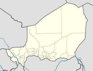 Bouza Location in Niger | |
| Coordinates: 14°25′20″N 6°2′43″E / 14.42222°N 6.04528°E | |
| Country | |
| Region | Tahoua Region |
| Department | Bouza Department |
| Commune | Bouza |
| Government | |
| • Type | Seat of Department, Commune |
| Elevation | 426 m (1,400 ft) |
| Population (2011) | |
| • Total | 88,225 |
| • Summer (DST) | UTC+1 |
Bouza is a town in southwestern Niger. A town of eight thousand, it is the administrative center of Bouza Department, part of Tahoua Region.
Culture and situation
Bouza Department is in a largely Hausa-speaking area, which has become in the last century an area of marginal agriculture. There are also populations of Fula and Tuareg peoples who traditionally engage in nomadic and semi-nomadic animal husbandry: the Fula Woadabe with cattle and the Tuareg largely with camel. The major highway of the region, completed in the 1970s, bypassed Bouza Department to the west, heading south from Regional capitol Tahoua to the large southern city of Birni-N'Konni near the Nigerian border. The major (unpaved) road in the area -- RN16 runs through Bouza town from Madaoua to the south to Keita in the north, before reaching Tahoua in the northwest of the Region.[1]
The town has a population estimated by the government of Niger in 2008 to be 8,375, up from 6,825 in the 2001 census and 5,496 in 1988. Bouza town is the site of a daily consumer market.[2] There is a small Departmental Hospital in Bouza, and the town has been the site of international healthcare efforts in the wake of the 2005 Niger food crisis which hit Tahoua Region particularly badly.[3]
References
- ^ Projet d’aménagement des routes Tibiri-Dakoro et Madaoua-Bouza-Tahoua[permanent dead link]. Banque Ouest-Africaine de Développement (BOAD) / République du Niger. OCIN Aprasial of funding, 2006.
- ^ Bouza, Niger Archived July 27, 2011, at the Wayback Machine: West-African Market Information Network, Price Statistics from the official West African Market Price Agencies - online.
- ^ HIV/AIDS and Poverty: CARE International Mata Masu Dubara (Women on the Move): Microcredit and Health Education for HIV/AIDS -Affected Women in Niger Archived July 20, 2007, at the Wayback Machine, INTERNATIONAL SERVICE PROGRAM, funded by the Zonta International Foundation,2004-2006 PROJECTS.
- "Falling Rain.com: Bouza, Niger Page". Archived from the original on 2007-10-25. Retrieved 2008-11-26.
14°30′33″N 5°58′36″E / 14.509144°N 5.976563°E