
Abala | |
|---|---|
Commune and village | |
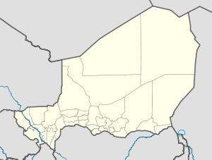 Abala Location of Abala | |
| Coordinates: 14°56′13″N 3°26′01″E / 14.93694°N 3.43361°E | |
| Country | |
| Region | Tillabéri Region |
| Department | Filingué Department |
| Elevation | 738 ft (225 m) |
| Population (2010) | |
| • Total | 75,117 |
| Time zone | UTC+1 (WAT) |
Abala, Niger is a village and rural commune in Niger.[1]
Geography
Abala lies in the Sahel in the Dallol Bosso and borders on the neighbouring state of Mali. The nearest communities in Niger are Tillia to the east, Sanam in the southeast, Kourfeye Centre in the south, Filingué the southwest and Banibangou in the west. The municipality comprises 45 administrative villages, 32 traditional villages, 72 hamlets, four camps and five water bodies.[2] The capital of the rural community is Abala consisting of the administrative villages Abala Arabe I, Abala Arabe II, Abala Guirnazan, Abala Maidagi, Abala Moulela and Abala Toudou.[3]
History
In 1964 Abala received the status of an administrative post (French: poste administratif).[4] In 2002, the City Centre and Kourfeye Sanam were released from the Canton Kourfey and independent rural community. In 2009 there were floods in many villages of the municipality, in which 7,210 residents were directly affected by property damage.[5]
Population
In the 2001 census there were 56,803 inhabitants of Abala. For 2010 75,177 inhabitants were estimated.[6] Approximately 80% of the population of Abala in 2011 were classified in a study of the French NGO ACTED as poor or very poor. More than 81% of the local population had no access to latrines.[7]
Economy and infrastructure
The community is located at the transition zone between the pastoral agriculture of the South Zone and the pure agriculture of the north.[8] National Highway 25 connects the village to the neighbouring communities Filingue and Sanam.
References
- ^ "CIRCONSCRIPTIONS ADMINISTRATIVES ET COLLECTIVITES TERRITORIALES DE LA REPUBLIQUE DU NIGER" (PDF). Niger's Ministry of Interior, Public Safety and Decentralization. March 2013. Archived from the original (PDF) on 30 May 2023. Retrieved January 1, 2024.
- ^ Répertoire National des Communes (RENACOM) Archived 2017-01-09 at the Wayback Machine. Website des Institut National de la Statistique
- ^ Republik Niger: Loi n° 2002-014 du 11 JUIN 2002 portant création des communes et fixant le nom de leurs chefs-lieux (Online-Version[permanent dead link]; PDF; 108 kB).
- ^ Edmond Séré de Rivières: Histoire du Niger. Berger-Levrault, Paris 1965, S. 275.
- ^ Situation des besoins des populations victimes d’inondations (2009) Archived 2014-02-02 at the Wayback Machine. Website des Centre d’Information et de Communication, 22 September 2009
- ^ Institut Nationale de la Statistique du Niger (Hrsg.): Annuaire statistique des cinquante ans d’indépendance du Niger. Niamey 2010 (Online-Version; PDF; 3,1 MB), p 56.
- ^ Départements de Tillabéri, Ouallam et Filingué, Region of Tillabéri. Evaluation of the Humanitarian Situation. Agence d'aide à la coopération technique et au développement (ACTED), Paris 2011 (Online-Version; PDF; 324 kB).
- ^ Comprendre l’économie des ménages ruraux au Niger. Save the Children UK, London 2009 (Online-Version Archived 2013-09-27 at the Wayback Machine), S. 8.
14°56′13″N 3°26′01″E / 14.93694°N 3.43361°E