

Zarrin Gol Rural District (Persian: دهستان زرين گل) is in the Central District of Aliabad County, Golestan province, Iran. Its capital is the village of Kordabad.[3]
At the National Census of 2006, its population was 9,292 in 2,194 households.[4] There were 9,785 inhabitants in 2,745 households at the following census of 2011.[5] At the most recent census of 2016, the population of the rural district was 10,175 in 2,997 households. The most populous of its 14 villages was Mehdiabad, with 2,848 people.[2]
The 14 villages are:
- Afratakhteh
- Alazman
- Amirabad-e Sorkh Mahalleh
- Chinu
- Khak-e Pir-e Zan
- Kordabad
- Mehdiabad
- Mian Rostaq
- Shirinabad
- Siah Rudbar
- Zarrin Gol
YouTube Encyclopedic
-
1/5Views:2 595 358127 615313 258416 91051 396
-
Inside the Underground City once Housed 20,000 People: Derinkuyu
-
Paradise Lost: The Controversial Hunt For The Garden Of Eden | Myth Hunters | Odyssey
-
Gwalior City | cultural capital of Madhya Pradesh | Gwalior fort 🌿🇮🇳
-
Russia: History, Geography, Economy and Culture
-
Iraq ka 1 Iraqi Dinar kitna Pakistani Rupees hota hai | Iraq currency rate in Pakistan
Transcription
References
- ^ OpenStreetMap contributors (11 October 2023). "Zarrin Gol Rural District (Aliabad County)" (Map). OpenStreetMap. Retrieved 11 October 2023.
- ^ a b "Census of the Islamic Republic of Iran, 1395 (2016)". AMAR (in Persian). The Statistical Center of Iran. p. 27. Archived from the original (Excel) on 29 March 2019. Retrieved 19 December 2022.
- ^ Habibi, Hassan (31 January 1379). "Creating divisional changes and reforms in Golestan province". Lamtakam (in Persian). Ministry of Interior, Council of Ministers. Archived from the original on 18 December 2023. Retrieved 13 February 2024.
- ^ "Census of the Islamic Republic of Iran, 1385 (2006)". AMAR (in Persian). The Statistical Center of Iran. p. 27. Archived from the original (Excel) on 20 September 2011. Retrieved 25 September 2022.
- ^ "Census of the Islamic Republic of Iran, 1390 (2011)". Syracuse University (in Persian). The Statistical Center of Iran. p. 27. Archived from the original (Excel) on 17 January 2023. Retrieved 19 December 2022.
Golestan Province, Iran | ||
|---|---|---|
| Capital | 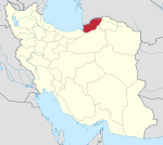 | |
| Counties and cities | ||
| Sights |
| |
| populated places | ||
| Capital | |||||||||||||||||
|---|---|---|---|---|---|---|---|---|---|---|---|---|---|---|---|---|---|
| Districts |
| ||||||||||||||||
This Aliabad County location article is a stub. You can help Wikipedia by expanding it. |