
Torkaman County
Persian: شهرستان ترکمن | |
|---|---|
 Location of Torkaman County in Golestan province (left, pink) | |
 Location of Golestan province in Iran | |
| Coordinates: 36°55′N 54°10′E / 36.917°N 54.167°E[1] | |
| Country | |
| Province | Golestan |
| Capital | Bandar Torkaman |
| Districts | Central, Si Joval |
| Population (2016)[2] | |
| • Total | 79,978 |
| Time zone | UTC+3:30 (IRST) |
| Torkaman County at GEOnet Names Server | |
Torkaman County (Persian: شهرستان ترکمن), formerly Bandar Torkaman County (شهرستان بندر ترکمن), is in Golestan province, Iran. Its capital is the city of Bandar Torkaman.[3]
YouTube Encyclopedic
-
1/5Views:5093034284062 073
-
Iran Golestan province, Gomishan wetland تالاب گميشان استان گلستان ايران
-
Iran Atra-Chal village, Gorgan, People different religious believes مذاهب روستاي اترا چال گرگان
-
استاد محترم الحاج یارجان تقصیر
-
Iran Shafi-Abad village, Ramian county, Strawberry festival جشنواره توت فرنگي روستاي شفيع آباد
-
مصاحبه با طلاب و مدرسین حوزه علمیه عرفانی عرفان آباد و سخنان زیبای علماء ترکمن صحرا
Transcription
Demographics
Population
At the time of the 2006 National Census, the county's population was 122,218 in 25,295 households.[4] The following census in 2011 counted 72,803 people in 17,772 households,[5] by which time Gomishan District had been separated from the county in the establishment of Gomishan County,[6] Faraghi Rural District established in the Central District, and Si Joval District established. At the 2016 census, the county's population was 79,978 in 21,315 households.[2]
After the census, the village of Si Joval was elevated to the status of a city.[7]
Administrative divisions
Torkaman County's population history and administrative structure over three consecutive censuses are shown in the following table.
| Administrative Divisions | 2006[4] | 2011[5] | 2016[2] |
|---|---|---|---|
| Central District | 63,493 | 60,370 | 66,520 |
| Faraghi RD | 5,238 | 5,656 | |
| Jafarbay-ye Jonubi RD | 18,448 | 6,396 | 6,894 |
| Bandar Torkaman (city) | 45,045 | 48,736 | 53,970 |
| Gomishan District[a] | 58,725 | ||
| Jafarbay-ye Gharbi RD | 13,650 | ||
| Jafarbay-ye Sharqi RD | 15,891 | ||
| Gomishan (city) | 15,639 | ||
| Siminshahr (city) | 13,545 | ||
| Si Joval District | 12,433 | 13,458 | |
| Qarah Su-ye Gharbi RD | 7,266 | 7,816 | |
| Qarah Su-ye Sharqi RD | 5,167 | 5,642 | |
| Si Joval (city)[b] | |||
| Total | 122,218 | 72,803 | 79,978 |
| RD = Rural District | |||
See also
![]() Media related to Torkaman County at Wikimedia Commons
Media related to Torkaman County at Wikimedia Commons
Notes
- ^ Transferred to Gomishan County[6]
- ^ Became a city after the 2016 census[7]
References
- ^ OpenStreetMap contributors (15 October 2023). "Torkaman County" (Map). OpenStreetMap. Retrieved 15 October 2023.
- ^ a b c "Census of the Islamic Republic of Iran, 1395 (2016)". AMAR (in Persian). The Statistical Center of Iran. p. 27. Archived from the original (Excel) on 29 March 2019. Retrieved 19 December 2022.
- ^ "Extraction of Bandar Torkaman (formerly Bandar Shah) and Gomishan parts from Gorgan County and creation of a county called Torkaman County centered on Bandar Torkaman". Laws and Regulations Portal of the Islamic Republic of Iran (in Persian). Revolutionary Council of the Islamic Republic of Iran. Archived from the original on 3 May 2023. Retrieved 13 February 2024.
- ^ a b "Census of the Islamic Republic of Iran, 1385 (2006)". AMAR (in Persian). The Statistical Center of Iran. p. 27. Archived from the original (Excel) on 20 September 2011. Retrieved 25 September 2022.
- ^ a b "Census of the Islamic Republic of Iran, 1390 (2011)". Syracuse University (in Persian). The Statistical Center of Iran. p. 27. Archived from the original (Excel) on 17 January 2023. Retrieved 19 December 2022.
- ^ a b Mahmudzadeh, Yahya. "Based on the agreement of the government, changes have been made in the divisions of the cities, districts and villages of Golestan province". Magiran (in Persian). Ministry of Interior, Cabinet of Ministers. Archived from the original on 17 November 2023. Retrieved 17 November 2023.
- ^ a b "Si Joval became the 34th city of Golestan". Tasnim News (in Persian). 15 June 2020. Archived from the original on 15 October 2023. Retrieved 15 October 2023.
Golestan Province, Iran | ||
|---|---|---|
| Capital | 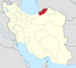 | |
| Counties and cities | ||
| Sights |
| |
| populated places | ||
| Capital | |||||||||
|---|---|---|---|---|---|---|---|---|---|
| Districts |
| ||||||||
This Golestan province location article is a stub. You can help Wikipedia by expanding it. |