

Soltanali Rural District (Persian: دهستان سلطانعلي) is in the Central District of Gonbad-e Kavus County, Golestan province, Iran. Its capital is the village of Soltanali.[3]
At the National Census of 2006, its population was 30,798 in 6,302 households.[4] There were 38,638 inhabitants in 9,281 households at the following census of 2011.[5] At the most recent census of 2016, the population of the rural district was 43,404 in 11,398 households. The most populous of its 29 villages was Gadmabad, with 8,250 people.[2]
YouTube Encyclopedic
-
1/3Views:44 81111 0541 153
-
Bogra at a glance (Part 1) - এক নজরে বগুড়া (শহর পর্ব) [ভ্রমণ গাইড]
-
Barguna, Discover what's in there. (EP 06)
-
Tangail Medical College 1st year Ceremony and joint Songs
Transcription
References
- ^ OpenStreetMap contributors (13 October 2023). "Soltanali Rural District (Gonbad-e Kavus County)" (Map). OpenStreetMap. Retrieved 13 October 2023.
- ^ a b "Census of the Islamic Republic of Iran, 1395 (2016)". AMAR (in Persian). The Statistical Center of Iran. p. 27. Archived from the original (Excel) on 29 March 2019. Retrieved 19 December 2022.
- ^ Habibi, Hassan (30 April 1372). "Carrying out reforms in the villages of Mazandaran province". Lamtakam (in Persian). Ministry of Interior, Political-Defense Commission of the Government Council. Archived from the original on 14 February 2024. Retrieved 14 February 2024.
- ^ "Census of the Islamic Republic of Iran, 1385 (2006)". AMAR (in Persian). The Statistical Center of Iran. p. 27. Archived from the original (Excel) on 20 September 2011. Retrieved 25 September 2022.
- ^ "Census of the Islamic Republic of Iran, 1390 (2011)". Syracuse University (in Persian). The Statistical Center of Iran. p. 27. Archived from the original (Excel) on 17 January 2023. Retrieved 19 December 2022.
Golestan Province, Iran | ||
|---|---|---|
| Capital | 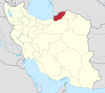 | |
| Counties and cities | ||
| Sights |
| |
| populated places | ||
This Gonbad-e Qabus County location article is a stub. You can help Wikipedia by expanding it. |