
Ortahisar | |
|---|---|
District and municipality | |
 Map showing Ortahisar District in Trabzon Province | |
 Ortahisar Location in Turkey | |
| Coordinates: 41°00′N 39°43′E / 41.000°N 39.717°E | |
| Country | Turkey |
| Province | Trabzon |
| Government | |
| • Mayor | Ahmet Kaya (CHP) |
| Area | 235 km2 (91 sq mi) |
| Elevation | 50 m (160 ft) |
| Population (2022)[1] | 335,628 |
| • Density | 1,400/km2 (3,700/sq mi) |
| Time zone | UTC+3 (TRT) |
| Area code | 0462 |
| Website | www |
Ortahisar is a municipality and district of Trabzon Province, Turkey.[2] Its area is 235 km2,[3] and its population is 335,628 (2022).[1] The district and municipality Ortahisar was created at the 2013 Turkish local government reorganisation from the former central district of Trabzon Province.[4][5] It covers the city of Trabzon and the surrounding countryside. On 31 March 2024, Ahmet Kaya (CHP) was elected mayor.
In April 2021, archaeologists announced the discovery of Roman and Byzantine period archeological remains. The southern part of the wicker columns and fortifications of the Roman emperor Hadrian's period, trench walls of Byzantine period dating back to 1460 have been discovered. Remains of Roman tiles and pottery were also discovered during the excavations. According to the Trabzon City Municipality, the excavation area is planned to be turned into an open-air museum.[6][7][8]
YouTube Encyclopedic
-
1/3Views:5289 212967
-
"ORTAHİSAR (NEVŞEHİR) tanıtım filmi
-
ortahisar'lı mucit
-
Ortahisar'ın Renkleri Klip
Transcription
Places of Interest
Composition
There are 87 neighbourhoods in Ortahisar District:[9]
- 1 Nolu Beşirli
- 1 Nolu Bostancı
- 1 Nolu Erdoğdu
- 2 Nolu Beşirli
- 2 Nolu Bostancı
- 2 Nolu Erdoğdu
- 3 Nolu Erdoğdu
- Ağıllı
- Akkaya
- Akoluk
- Aktoprak
- Akyazı
- Aydınlıkevler
- Ayvalı
- Bahçecik
- Bengisu
- Beştaş
- Boztepe
- Bulak
- Çağlayan
- Çamoba
- Çarşı
- Çilekli
- Çimenli
- Çömlekçi
- Çukurçayır
- Cumhuriyet
- Değirmendere
- Doğançay
- Dolaylı
- Düzyurt
- Esentepe
- Esenyurt
- Fatih
- Fatih Sultan
- Gazipaşa
- Geçit
- Gölçayır
- Gözalan
- Gülbaharhatun
- Gündoğdu
- Gürbulak
- Hızırbey
- İncesu
- İnönü
- İskenderpaşa
- Kalkınma
- Kamışlı
- Kanuni
- Karakaya
- Karlık
- Karşıyaka
- Kavala
- Kaymaklı
- Kemerkaya
- Kireçhane
- Konaklar
- Kozluca
- Kurtuluş
- Kutlugün
- Okçular
- Ortahisar
- Özbirlik
- Pazarkapı
- Pelitli
- Pınaraltı
- Sanayi
- Sayvan
- Sevimli
- Soğuksu
- Subaşı
- Toklu
- Tosköy
- Uğurlu
- Üniversite
- Yalı
- Yalıncak
- Yenicuma
- Yeniköy
- Yenimahalle
- Yeşilbük
- Yeşilhisar
- Yeşilköy
- Yeşilova
- Yeşiltepe
- Yeşilvadi
- Yeşilyurt
References
- ^ a b "Address-based population registration system (ADNKS) results dated 31 December 2022, Favorite Reports" (XLS). TÜİK. Retrieved 19 September 2023.
- ^ Büyükşehir İlçe Belediyesi, Turkey Civil Administration Departments Inventory. Retrieved 19 September 2023.
- ^ "İl ve İlçe Yüz ölçümleri". General Directorate of Mapping. Retrieved 19 September 2023.
- ^ "İl İdaresi ve Mülki Bölümler Şube Müdürlüğü İstatistikleri - İl ve İlçe Kuruluş Tarihleri" (PDF) (in Turkish). p. 80. Retrieved 12 October 2023.
- ^ "Law No. 6360". Official Gazette (in Turkish). 6 December 2012.
- ^ Şafak, Yeni (10 April 2021). "Otopark projesi için yapılan kazı sırasında bulundu: Açık hava müzesi olacak". Yeni Şafak (in Turkish). Retrieved 14 April 2021.
- ^ SAYKAL/TRABZON, (DHA), Selay. "Trabzon'da kazı çalışmaları sırasında bulundu! Müzeye dönüştürülecek". www.hurriyet.com.tr (in Turkish). Retrieved 14 April 2021.
- ^ "Trabzon'da kazı çalışmaları sırasında bulundu! Müzeye dönüştürülecek". www.msn.com. Retrieved 14 April 2021.
- ^ Mahalle, Turkey Civil Administration Departments Inventory. Retrieved 19 September 2023.
Ortahisar in Trabzon Province of Turkey | |||||||||||||||||||||||||||
|---|---|---|---|---|---|---|---|---|---|---|---|---|---|---|---|---|---|---|---|---|---|---|---|---|---|---|---|
| Districts |  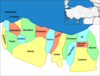 | ||||||||||||||||||||||||||
|
Metropolitan municipalities are bolded. | |||||||||||||||||||||||||||
| International | |
|---|---|
| National | |