
Şalpazarı | |
|---|---|
District and municipality | |
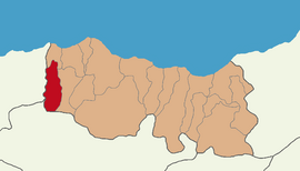 Map showing Şalpazarı District in Trabzon Province | |
 Şalpazarı Location in Turkey | |
| Coordinates: 40°56′32″N 39°11′39″E / 40.94222°N 39.19417°E | |
| Country | Turkey |
| Province | Trabzon |
| Government | |
| • Mayor | Refik Kurukız (MHP) |
| Area | 161 km2 (62 sq mi) |
| Population (2022)[1] | 10,434 |
| • Density | 65/km2 (170/sq mi) |
| Time zone | TRT (UTC+3) |
| Postal code | 61670 |
| Area code | 0462 |
| Climate | Cfb |
| Website | www |
Şalpazarı is a municipality and district of Trabzon Province, Turkey.[2] Its area is 161 km2,[3] and its population is 10,434 (2022).[1] The mayor is Refik Kurukız (MHP). Şalpazarı is a home to sizeable Chepni Turkmen population.
Şalpazarı has a creek called Ağasar.
YouTube Encyclopedic
-
1/3Views:3 66124 9352 337
-
Trabzon - Şalpazarı Belgeseli
-
Düzköy Köyü - Şalpazarı - Trabzon - Agasar.Net
-
Çetrik Köyü 2007 (Trabzon - Ağasar (Şalpazarı))..
Transcription
History
During the Ottoman period, Şalpazarı was a village that was a part of the town of Görele. In 1809 Şalpazarı became a part of Vakfıkebir.[4] Then in 1987 it gained town status.
Composition
There are 30 neighbourhoods in Şalpazarı District:[5]
- Ağırtaş
- Akçiriş
- Çamkiriş
- Çamlıca
- Çarlaklı
- Çetrik
- Dereköy
- Doğancı
- Dorukkiriş
- Düzköy
- Fidanbaşı
- Geyikli
- Gökçeköy
- Gölkiriş
- Güdün
- Kabasakal
- Kalecik
- Karakaya
- Kasımağzı
- Kireç
- Kuzuluk
- Pelitçik
- Sayvançatak
- Simenli
- Sinlice
- Sugören
- Sütpınar
- Tepeağzı
- Turalıuşağı
- Üzümözü
References
- ^ a b "Address-based population registration system (ADNKS) results dated 31 December 2022, Favorite Reports" (XLS). TÜİK. Retrieved 19 September 2023.
- ^ Büyükşehir İlçe Belediyesi, Turkey Civil Administration Departments Inventory. Retrieved 19 September 2023.
- ^ "İl ve İlçe Yüz ölçümleri". General Directorate of Mapping. Retrieved 19 September 2023.
- ^ "Karalahana.com: Turkey's Black Sea region (Pontos) history, culture and travel guide".
- ^ Mahalle, Turkey Civil Administration Departments Inventory. Retrieved 19 September 2023.
External links
- District governor's official website (in Turkish)
Şalpazarı in Trabzon Province of Turkey | |||||||||||||||||||||||||||
|---|---|---|---|---|---|---|---|---|---|---|---|---|---|---|---|---|---|---|---|---|---|---|---|---|---|---|---|
| Districts |  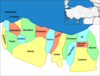 | ||||||||||||||||||||||||||
|
Metropolitan municipalities are bolded. | |||||||||||||||||||||||||||
This article about a Black Sea Region of Turkey location is a stub. You can help Wikipedia by expanding it. |