
Dernekpazarı | |
|---|---|
District and municipality | |
 Map showing Dernekpazarı District in Trabzon Province | |
 Dernekpazarı Location in Turkey | |
| Coordinates: 40°48′N 40°14′E / 40.800°N 40.233°E | |
| Country | Turkey |
| Province | Trabzon |
| Government | |
| • Mayor | Mehmet Aşık (AKP) |
| Area | 89 km2 (34 sq mi) |
| Population (2022)[1] | 3,761 |
| • Density | 42/km2 (110/sq mi) |
| Time zone | UTC+3 (TRT) |
| Postal code | 61950 |
| Area code | 0462 |
| Climate | Cfa |
| Website | www |
Dernekpazarı (formerly: Kondu, Kondualtı) is a municipality and district of Trabzon Province, Turkey.[2] Its area is 89 km2,[3] and its population is 3,761 (2022).[1] The current mayor of the town is Mehmet Aşık (AKP). Dernekpazarı is part of the Solaklı river valley system; it lies between the coastal Of district and the alpine Çaykara district.
YouTube Encyclopedic
-
1/3Views:8801 0451 609
-
Dernekpazarı Belgeseli
-
Of-Hayrat-Dernekpazarı-Çaykara ve Uzungölden görüntüler HD Kalitesiyle
-
Of Kirazköy Taşhanpazarı Dernekpazarı Çaykara Uzungöl Solaklı Vadisi
Transcription
History
The history of Dernekpazarı is closely related to the history of the Trabzon, the largest city of the Black Sea Region. Depending who ruled the Trabzon Province, the hill country came under Roman, Byzantine and Ottoman sovereignty. The population consisted largely of Pontic Greeks who converted to Islam during the 17th and 18th centuries. Currently the Of dialect of Pontic Greek (locally called 'Romeyka') is still spoken in the villages and nearly all locally current place names are in Greek. A few residents of the district who retained their Christian faith at the beginning of the 20th century were resettled in the town of Nea Trapezounta, near Katerini in Greece, in the wake of the population exchange between Greece and Turkey in 1923.
Composition
There are 14 neighbourhoods in Dernekpazarı District (Pontic Greek names in brackets):[4]
References
- ^ a b "Address-based population registration system (ADNKS) results dated 31 December 2022, Favorite Reports" (XLS). TÜİK. Retrieved 19 September 2023.
- ^ Büyükşehir İlçe Belediyesi, Turkey Civil Administration Departments Inventory. Retrieved 19 September 2023.
- ^ "İl ve İlçe Yüz ölçümleri". General Directorate of Mapping. Retrieved 19 September 2023.
- ^ Mahalle, Turkey Civil Administration Departments Inventory. Retrieved 19 September 2023.
External links
- District governor's official website (in Turkish)
Dernekpazarı in Trabzon Province of Turkey | |||||||||||||||||||||||||||
|---|---|---|---|---|---|---|---|---|---|---|---|---|---|---|---|---|---|---|---|---|---|---|---|---|---|---|---|
| Districts |  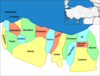 | ||||||||||||||||||||||||||
|
Metropolitan municipalities are bolded. | |||||||||||||||||||||||||||
This article about a Black Sea Region of Turkey location is a stub. You can help Wikipedia by expanding it. |