
Navlya
Навля | |
|---|---|
 Coat of arms | |
Location of Navlya  | |
 Navlya Location of Navlya 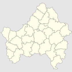 Navlya Navlya (Bryansk Oblast) | |
| Coordinates: 52°49′41″N 34°29′56″E / 52.82806°N 34.49889°E | |
| Country | Russia |
| Federal subject | Bryansk Oblast |
| Founded | 1904 |
| Town status since | 1938 |
| Population | |
| • Total | 14,361 |
| • Estimate (2018)[2] | 14,403 (+0.3%) |
| • Municipal district | Navlinsky Municipal District |
| • Urban settlement | Navlinsky Urban Settlement |
| • Capital of | Navlinsky Municipal District, Navlinsky Urban Settlement |
| Time zone | UTC+3 (MSK |
| Postal code(s)[4] | 242130 |
| Dialing code(s) | +7 48342 |
| OKTMO ID | 15638151051 |
Navlya (Russian: На́вля) is an urban-type settlement in Bryansk Oblast, Russia. It is the administrative center of Navlinsky District. Population: 15,536 (2021 Census);[5] 14,361 (2010 Census);[1] 14,014 (2002 Census);[6] 13,709 (1989 Census).[7]
History
The town was founded in 1904 in connection with the construction of the Moscow-Kiev-Voronezh railway. Since 1938 the settlement is mostly urban.
During the German occupation in World War II, from November 1941 to September 1943, it was part of Navlya Lokotskogo District. Guerrilla groups were active in the woods near Navlya, While an underground Komsomol group operated in the town.[citation needed]
Economy
In the settlement there are several industries including a repair plant, Auto Aggregate Plant (manufacture of driveshafts), Factory "Promsvyaz" (manufacture of machinery for the construction of cable lines), Food Factory, conducted asphalt production and harvesting.[citation needed]
Place of interest
In Navlya there is the Museum of Partisan Glory, underground guerrillas monument "Memory Wall" with a bust of the commander of one of the groups, Peter Derevyanko, as well as a monument to the soldiers of the 10th separate tank brigade of the Bryansk Front-based around an IS-2 tank mounted on a pedestal. In addition, in the town is a monument to Lenin, the stele in honor of the liberation of the city, a monument and burial of defenders and civilians Navlya on the forecourt. Knyazev is a monument to the defenders of the city, in the park. Derevianko - a monument to the liquidators of the Chernobyl accident.
References
- ^ a b Russian Federal State Statistics Service (2011). Всероссийская перепись населения 2010 года. Том 1 [2010 All-Russian Population Census, vol. 1]. Всероссийская перепись населения 2010 года [2010 All-Russia Population Census] (in Russian). Federal State Statistics Service.
- ^ "26. Численность постоянного населения Российской Федерации по муниципальным образованиям на 1 января 2018 года". Federal State Statistics Service. Archived from the original on 26 July 2018. Retrieved 23 January 2019.
- ^ "Об исчислении времени". Официальный интернет-портал правовой информации (in Russian). 3 June 2011. Retrieved 19 January 2019.
- ^ Почта России. Информационно-вычислительный центр ОАСУ РПО. (Russian Post). Поиск объектов почтовой связи (Postal Objects Search) (in Russian)
- ^ Russian Federal State Statistics Service. Всероссийская перепись населения 2020 года. Том 1 [2020 All-Russian Population Census, vol. 1] (XLS) (in Russian). Federal State Statistics Service.
- ^ Russian Federal State Statistics Service (21 May 2004). Численность населения России, субъектов Российской Федерации в составе федеральных округов, районов, городских поселений, сельских населённых пунктов – районных центров и сельских населённых пунктов с населением 3 тысячи и более человек [Population of Russia, Its Federal Districts, Federal Subjects, Districts, Urban Localities, Rural Localities—Administrative Centers, and Rural Localities with Population of Over 3,000] (XLS). Всероссийская перепись населения 2002 года [All-Russia Population Census of 2002] (in Russian).
- ^ Всесоюзная перепись населения 1989 г. Численность наличного населения союзных и автономных республик, автономных областей и округов, краёв, областей, районов, городских поселений и сёл-райцентров [All Union Population Census of 1989: Present Population of Union and Autonomous Republics, Autonomous Oblasts and Okrugs, Krais, Oblasts, Districts, Urban Settlements, and Villages Serving as District Administrative Centers]. Всесоюзная перепись населения 1989 года [All-Union Population Census of 1989] (in Russian). Институт демографии Национального исследовательского университета: Высшая школа экономики [Institute of Demography at the National Research University: Higher School of Economics]. 1989 – via Demoscope Weekly.