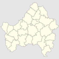
Dubrovka
Дубровка | |
|---|---|
| Coordinates: 53°41′29″N 33°30′42″E / 53.69139°N 33.51167°E | |
| Country | Russia |
| Federal subject | Bryansk Oblast |
| Founded | 1868 |
| Town status since | 2012 |
| Population | |
| • Total | 8,015 |
| • Estimate (2018)[2] | 7,195 (−10.2%) |
| • Municipal district | Dubrovsky Municipal District |
| • Urban settlement | Dubrovsky Urban Settlement |
| • Capital of | Dubrovsky Municipal District, Dubrovsky Urban Settlement |
| Time zone | UTC+3 (MSK |
| Postal code(s)[4] | 242750 |
| Dialing code(s) | +7 48332 |
| OKTMO ID | 15612151051 |
Dubrovka (Russian: Ду́бровка) is a settlement in Bryansk Oblast, Russia. Population: 6,793 (2021 Census).[5]
The town is located on Sesche on the river, a tributary of the Desna River. Railway station is located on the Bryansk-Smolensk line, 81 kilometers north-west of Bryansk.
History
The settlement was founded in 1868 in connection with the construction of the Oryol-Vitebsk railroad (the station was named after a nearby village). In the 1880s there were industries including distillery, sawmill, mills, churns. In 1912, twine factory was built.
In 1929 it became the district center and in 1931 it was granted an urban-type settlement status.
In 2012 its status was demoted to 'settlement'.
References
- ^ Russian Federal State Statistics Service (2011). Всероссийская перепись населения 2010 года. Том 1 [2010 All-Russian Population Census, vol. 1]. Всероссийская перепись населения 2010 года [2010 All-Russia Population Census] (in Russian). Federal State Statistics Service.
- ^ "26. Численность постоянного населения Российской Федерации по муниципальным образованиям на 1 января 2018 года". Federal State Statistics Service. Retrieved 23 January 2019.
- ^ "Об исчислении времени". Официальный интернет-портал правовой информации (in Russian). 3 June 2011. Retrieved 19 January 2019.
- ^ Почта России. Информационно-вычислительный центр ОАСУ РПО. (Russian Post). Поиск объектов почтовой связи (Postal Objects Search) (in Russian)
- ^ Russian Federal State Statistics Service. Всероссийская перепись населения 2020 года. Том 1 [2020 All-Russian Population Census, vol. 1] (XLS) (in Russian). Federal State Statistics Service.


