
Kütahya District | |
|---|---|
 Map showing Kütahya District in Kütahya Province | |
 Kütahya District Location in Turkey  Kütahya District Kütahya District (Turkey Aegean) | |
| Coordinates: 39°25′N 29°59′E / 39.417°N 29.983°E | |
| Country | Turkey |
| Province | Kütahya |
| Seat | Kütahya |
| Area | 2,470 km2 (950 sq mi) |
| Population (2022) | 282,243 |
| • Density | 110/km2 (300/sq mi) |
| Time zone | TRT (UTC+3) |
Kütahya District (also: Merkez, meaning "central" in Turkish) is a district of the Kütahya Province of Turkey. Its seat is the city of Kütahya.[1] Its area is 2,470 km2,[2] and its population is 282,243 (2022).[3]
Composition
There are two municipalities in Kütahya District:[1][4]
There are 109 villages in Kütahya District:[5]
- Ağaçköy
- Ağızören
- Ahiler
- Ahmetoluğu
- Akçamescit
- Akoluk
- Akpınar
- Aloğlu
- Anasultan
- Arslanlı
- Ayvalı
- Başören
- Bayat
- Bayramşah
- Belkavak
- Büyüksaka
- Çavuşçiftliği
- Çayca
- Çifteoluklar
- Çobanlar
- Çöğürler
- Çubukiçi
- Damlalıkaraağaç
- Darıca
- Dedik
- Demirciören
- Demirözü
- Dereköy
- Doğa
- Doğalar
- Doğarslan
- Doğluşah
- Elmacık
- Elmalı
- Eskiyüreğil
- Eynegazi
- Fındıkköy
- Fincanburnu
- Gedikoğluçiftliği
- Gelinkaya
- Göçeri
- Göynükören
- Güllüdere
- Gümüşköy
- Güvem
- Hamidiyekızılcaören
- Haymana
- İhsaniye
- İncik
- İnli
- İshakçılar
- Işıkkara
- Karaağaç
- Karacaören
- Karaöz
- Karsak
- Kaynarca
- Kepez
- Kınık
- Kıranşeyh
- Kirazlıyaylası
- Kireççiftliği
- Kızık
- Kızılcakaya
- Kızılcaören
- Koçak
- Köprüören
- Körpe
- Körs
- Kozluca
- Kumluyurt
- Kuyusinir
- Kükürt
- Lütfiye
- Mahmudiye
- Makasalanı
- Muhatboğazı
- Mustafalar
- Nusretköy
- Ortaca
- Ovacık
- Pullar
- Sabuncupınar
- Sağırlar
- Sakaçiftliği
- Sekiören
- Seydiköy
- Sırören
- Sobran
- Sofca
- Soğukçeşme
- Söğüt
- Söğütyaylası
- Sökmen
- Sulu
- Sünnetyenice
- Tepeköy
- Teşvikiye
- Turgutlar
- Uluköy
- Ürünlüçiftliği
- Yakaca
- Yaylababa
- Yazlıca
- Yenice
- Yenikaracaören
- Yenikızılcaören
- Yeşilbayır
- Yumaklı
References
- ^ a b İl Belediyesi, Turkey Civil Administration Departments Inventory. Retrieved 22 May 2023.
- ^ "İl ve İlçe Yüz ölçümleri". General Directorate of Mapping. Retrieved 22 May 2023.
- ^ "Address-based population registration system (ADNKS) results dated 31 December 2022, Favorite Reports" (XLS). TÜİK. Retrieved 22 May 2023.
- ^ Belde Belediyesi, Turkey Civil Administration Departments Inventory. Retrieved 22 May 2023.
- ^ Köy, Turkey Civil Administration Departments Inventory. Retrieved 22 May 2023.
Kütahya District in Kütahya Province of Turkey | |||||||||||||||||||||||||||
|---|---|---|---|---|---|---|---|---|---|---|---|---|---|---|---|---|---|---|---|---|---|---|---|---|---|---|---|
| Districts |  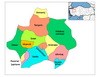 | ||||||||||||||||||||||||||
|
Metropolitan municipalities are bolded. | |||||||||||||||||||||||||||
| Municipalities | |
|---|---|
| Villages |
|
This article about an Aegean Region of Turkey location is a stub. You can help Wikipedia by expanding it. |