
Çavdarhisar District | |
|---|---|
 Map showing Çavdarhisar District in Kütahya Province | |
 Çavdarhisar District Location in Turkey  Çavdarhisar District Çavdarhisar District (Turkey Aegean) | |
| Coordinates: 39°12′N 29°37′E / 39.200°N 29.617°E | |
| Country | Turkey |
| Province | Kütahya |
| Seat | Çavdarhisar |
| Government | |
| • Kaymakam | Metin Korkmaz |
| Area | 429 km2 (166 sq mi) |
| Population (2022) | 5,771 |
| • Density | 13/km2 (35/sq mi) |
| Time zone | UTC+3 (TRT) |
| Website | www |
Çavdarhisar District is a district of the Kütahya Province of Turkey. Its seat is the town of Çavdarhisar.[1] Its area is 429 km2,[2] and its population is 5,771 (2022).[3]
Composition
There is one municipality in Çavdarhisar District:[1]
There are 23 villages in Çavdarhisar District:[4]
- Afşar
- Ağarı
- Akpınar
- Barağı
- Çamköy
- Çatköy
- Demiroluk
- Doğancılar
- Efeler
- Efendiköprüsü
- Gökağaç
- Gökler
- Hacıbekir
- Hacımahmut
- İlçikören
- Kızık
- Pusatlar
- Susuzkaya
- Tepecik
- Yağdığın
- Yenicearmutcuk
- Yeşildere
- Zobu
References
- ^ a b İlçe Belediyesi, Turkey Civil Administration Departments Inventory. Retrieved 22 May 2023.
- ^ "İl ve İlçe Yüz ölçümleri". General Directorate of Mapping. Retrieved 22 May 2023.
- ^ "Address-based population registration system (ADNKS) results dated 31 December 2022, Favorite Reports" (XLS). TÜİK. Retrieved 22 May 2023.
- ^ Köy, Turkey Civil Administration Departments Inventory. Retrieved 22 May 2023.
Çavdarhisar District in Kütahya Province of Turkey | |||||||||||||||||||||||||||
|---|---|---|---|---|---|---|---|---|---|---|---|---|---|---|---|---|---|---|---|---|---|---|---|---|---|---|---|
| Districts |  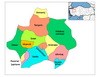 | ||||||||||||||||||||||||||
|
Metropolitan municipalities are bolded. | |||||||||||||||||||||||||||
This article about an Aegean Region of Turkey location is a stub. You can help Wikipedia by expanding it. |