
 | |
| Mission type | Navigation |
|---|---|
| Operator | ISRO |
| COSPAR ID | 2016-015A |
| SATCAT no. | 41384 [1] |
| Website | http://www.isro.gov.in/Spacecraft/irnss-1f |
| Mission duration | 12 years |
| Spacecraft properties | |
| Spacecraft | IRNSS-1F |
| Spacecraft type | Satellite |
| Bus | I-1K |
| Manufacturer | ISRO Satellite Centre Space Applications Centre |
| Launch mass | 1,425 kilograms (3,142 lb) |
| Dry mass | 598 kilograms (1,318 lb) |
| Power | 1660 W |
| Start of mission | |
| Launch date | 10:31:00, March 10, 2016 (UTC) |
| Rocket | PSLV-XL C32 |
| Launch site | Satish Dhawan Second |
| Contractor | ISRO |
| Orbital parameters | |
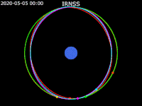
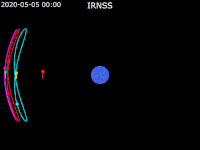
| Reference system | Geocentric |
| Regime | Sub-Geosynchronous Transfer Orbit (sub-GTO)[2] |
| Perigee altitude | 35,708 km (22,188 mi)[3] |
| Apogee altitude | 35,862 km (22,284 mi)[3] |
| Inclination | 32.5 deg E |
IRNSS-1F is the sixth navigation satellite out of seven in the Indian Regional Navigational Satellite System (IRNSS) series of satellites after IRNSS-1A, IRNSS-1B, IRNSS-1C, IRNSS-1D and IRNSS-1E. The satellite is one among the seven of the IRNSS constellation of satellites launched to provide navigational services to the region.[4]
YouTube Encyclopedic
-
1/2Views:4207 424
-
IRNSS 1G - NAVIC
-
How Indian GPS Navic Works ? |Navic vs GPS| What is NAVIC?| IRNSS Explained | Indian GPS Navic| ISRO
Transcription
Launch
It was launched aboard a PSLV-XL rocket bearing flight number C32 and was successfully put into geosynchronous orbit at 1601 hrs IST on 10 March 2016.[5][6]
Spacecraft
The satellite carries two types of payloads. The navigation payload transmit navigation service signals to users and ranging payload consists of C-band transponder that facilitates accurate determination of the range of the satellite.[4]
It carries Corner Cube Retro Reflectors for laser ranging.[7]
IRNSS-1F has a 12-year mission life.[2]


See also
- Communication-Centric Intelligence Satellite (CCI-Sat)
- GPS-aided geo-augmented navigation (GAGAN)
- Satellite navigation
References
- ^ "NORAD Catalog Number 41384". www.celestrak.com. Retrieved 2017-06-08.
- ^ a b "ISRO successfully launches navigation satellite IRNSS-1F.Earlier satellite launch of IRNSS 1E was in January 2016 - PSLV C31". Retrieved 2016-03-10.
- ^ a b Peat, Chris (2022-10-07). "IRNSS 1F". Heavens-Above. Retrieved 2022-10-08.
- ^ a b "India's sixth navigation satellite, IRNSS-1F, put into orbit". The Hindu. 10 March 2016. Retrieved 2016-03-10.
- ^ "IRNSS". space.skyrocket.de. Retrieved 6 December 2014.
- ^ "IRNSS-1F". isro.gov.in. Archived from the original on 8 March 2016. Retrieved 9 March 2016.
- ^ "IRNSS-1F - ISRO". www.isro.gov.in. Archived from the original on 2017-07-31. Retrieved 2017-06-08.
External links
| Satellites | ||
|---|---|---|
| Related articles | ||
| Satellites |
|  | ||||||||||
|---|---|---|---|---|---|---|---|---|---|---|---|---|
| Space probes |
| |||||||||||
| Human spaceflight | ||||||||||||
| ||||||||||||