
Hoxud County
| |
|---|---|
 | |
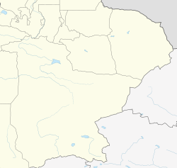
 Location of Hoxud County (red) within Bayingolin Prefecture (yellow) and Xinjiang | |
 Hoxud Location of the seat in Xinjiang  Hoxud Hoxud (Xinjiang)  Hoxud Hoxud (China) | |
| Coordinates: 42°16′N 86°51′E / 42.267°N 86.850°E | |
| Country | China |
| Autonomous region | Xinjiang |
| Autonomous prefecture | Bayingolin |
| County seat | Tewilga |
| Area | |
| • Total | 12,739.86 km2 (4,918.89 sq mi) |
| Population (2020)[1] | |
| • Total | 59,299 |
| • Density | 4.7/km2 (12/sq mi) |
| Time zone | UTC+8 (China Standard[a]) |
| Website | www |
| Hoxud County | |||||||||||
|---|---|---|---|---|---|---|---|---|---|---|---|
| Chinese name | |||||||||||
| Simplified Chinese | 和硕县 | ||||||||||
| Traditional Chinese | 和碩縣 | ||||||||||
| |||||||||||
| Mongolian name | |||||||||||
| Mongolian Cyrillic | Хошууд сиан | ||||||||||
| Mongolian script | ᠬᠣᠱᠤᠳ ᠰᠢᠨ | ||||||||||
| |||||||||||
| Uyghur name | |||||||||||
| Uyghur | خوشۇت ناھىيىسى | ||||||||||
| |||||||||||
Hoxud County is a county in the Xinjiang Uyghur Autonomous Region and is under the administration of the Bayin'gholin Mongol Autonomous Prefecture. It contains an area of 12,753 km2 (4,924 sq mi). According to the 2002 census, it has a population of 60,000.
Demographics
Administrative divisions
Hoxud County is made up of 3 towns, 3 townships, and 1 ethnic township.
| Name | Simplified Chinese | Hanyu Pinyin | Uyghur (UEY) | Uyghur Latin (ULY) | Mongolian (traditional) | Mongolian (Cyrillic) | Administrative division code | |
|---|---|---|---|---|---|---|---|---|
| Towns | ||||||||
| Tewilga Town | 特吾里克镇 | Tèwúlǐkè Zhèn | تېۋىلغا بازىرى | tëwilgha baziri | ᠲᠠᠪᠢᠯᠭᠠ ᠪᠠᠯᠭᠠᠰᠤᠨ | Тавилга балгас | 652828100 | |
| Tagarqi Town | 塔哈其镇 | Tǎhāqí Zhèn | تاغارچى بازىرى | tagharchi baziri | ᠲᠠᠭᠠᠷᠴᠢ ᠪᠠᠯᠭᠠᠰᠤᠨ | Таарч балгас | 652828101 | |
| Qoh Town | 曲惠镇 | Qūhuì Zhèn | چۇقۇ بازىرى | chuqu baziri | ᠴᠣᠬᠣ ᠪᠠᠯᠭᠠᠰᠤᠨ | Цох балгас | 652828102 | |
| Townships | ||||||||
| Suhat Township | 苏哈特乡 | Sūhātè Xiāng | سوخاتۇ يېزىسى | soxatu yëzisi | ᠰᠤᠬᠠᠢᠲᠤ ᠰᠤᠮᠤᠨ | Сухайт суман | 652828203 | |
| Narinker Township | 乃仁克尔乡 | Nǎirénkè'ěr Xiāng | نەرىنكىر يېزىسى | nerinkir yëzisi | ᠨᠠᠷᠢᠩᠭᠡᠷ ᠰᠤᠮᠤᠨ | Нэрэнгэр суман | 652828204 | |
| Shintara Township | 新塔热乡 | Xīntǎrè Xiāng | شىنتارا يېزىسى | shintara yëzisi | ᠱᠢᠨᠡᠲ᠋ᠠᠷᠢᠶᠠ ᠰᠤᠮᠤᠨ | Шнэтэрье суман | 652828205 | |
| Ethnic Township | ||||||||
| Uxxaktal Hui Ethnic Township | 乌什塔拉回族民族乡 | Wūshítǎlā Huízú Mínzúxiāng | ئۇششاقتال خۇيزۇ يېزىسى | Ushshaqtal xuyzu yëzisi | ᠤᠱᠢᠲᠠᠯᠠ ᠬᠣᠲᠣᠩ ᠦᠨᠳᠦᠰᠦᠲᠡᠨ ᠦ ᠰᠤᠮᠤᠨ | Уштэл хотон үндэстэний суман | 652828200 | |
Others:
- Qingshuihe Farm (清水河农场, چىڭسىخوزا دېھقانچىلىق مەيدانى, ᠴᠢᠩ ᠱᠦᠢ ᠾᠧ
ᠲᠠᠷᠢᠶᠠᠯᠠᠩ ᠤᠨ
ᠲᠠᠯᠠᠪᠠᠢ) - Malan Public Security Bureau Jurisdiction, Hoxud County (和硕县马兰公安管区)
Climate
| Climate data for Hoxud, elevation 1,085 m (3,560 ft), (1991–2020 normals) | |||||||||||||
|---|---|---|---|---|---|---|---|---|---|---|---|---|---|
| Month | Jan | Feb | Mar | Apr | May | Jun | Jul | Aug | Sep | Oct | Nov | Dec | Year |
| Mean daily maximum °C (°F) | −4.0 (24.8) |
3.3 (37.9) |
12.8 (55.0) |
21.3 (70.3) |
26.3 (79.3) |
29.9 (85.8) |
31.3 (88.3) |
30.6 (87.1) |
26.0 (78.8) |
18.1 (64.6) |
7.8 (46.0) |
−1.9 (28.6) |
16.8 (62.2) |
| Daily mean °C (°F) | −11.3 (11.7) |
−4.2 (24.4) |
5.2 (41.4) |
13.5 (56.3) |
18.5 (65.3) |
22.5 (72.5) |
23.6 (74.5) |
22.1 (71.8) |
16.5 (61.7) |
8.0 (46.4) |
−0.3 (31.5) |
−8.1 (17.4) |
8.8 (47.9) |
| Mean daily minimum °C (°F) | −17.0 (1.4) |
−11.0 (12.2) |
−2.4 (27.7) |
5.3 (41.5) |
9.8 (49.6) |
14.3 (57.7) |
15.8 (60.4) |
14.0 (57.2) |
8.2 (46.8) |
0.5 (32.9) |
−6.1 (21.0) |
−12.9 (8.8) |
1.5 (34.8) |
| Average precipitation mm (inches) | 2.2 (0.09) |
3.0 (0.12) |
3.2 (0.13) |
6.8 (0.27) |
14.2 (0.56) |
17.4 (0.69) |
22.6 (0.89) |
15.1 (0.59) |
6.9 (0.27) |
4.6 (0.18) |
2.9 (0.11) |
2.8 (0.11) |
101.7 (4.01) |
| Average precipitation days (≥ 0.1 mm) | 3.3 | 1.5 | 1.0 | 1.6 | 3.1 | 5.1 | 7.2 | 5.3 | 3.0 | 1.5 | 1.0 | 3.1 | 36.7 |
| Average snowy days | 8.8 | 2.9 | 0.7 | 0.5 | 0 | 0 | 0 | 0 | 0 | 0.1 | 1.5 | 8.4 | 22.9 |
| Average relative humidity (%) | 75 | 63 | 43 | 38 | 43 | 49 | 56 | 58 | 61 | 65 | 69 | 77 | 58 |
| Mean monthly sunshine hours | 173.2 | 200.2 | 253.3 | 267.3 | 299.6 | 289.0 | 290.5 | 287.7 | 281.0 | 259.9 | 202.6 | 140.8 | 2,945.1 |
| Percent possible sunshine | 58 | 66 | 67 | 66 | 66 | 63 | 64 | 68 | 77 | 78 | 70 | 50 | 66 |
| Source: China Meteorological Administration[3][4] | |||||||||||||
Notes
- ^ Locals in Xinjiang frequently observe UTC+6 (Xinjiang Time), 2 hours behind Beijing.
References
- ^ Xinjiang: Prefectures, Cities, Districts and Counties
- ^ 3-7 各地、州、市、县(市)分民族人口数 [3-7 Population by Nationality by Prefecture, State, City and County (City)]. tjj.xinjiang.gov.cn (in Chinese). Statistical Bureau of Xinjiang Uyghur Autonomous Region. 2020-06-10. Archived from the original on 2020-11-01. Retrieved 2021-06-11.
- ^ 中国气象数据网 – WeatherBk Data (in Simplified Chinese). China Meteorological Administration. Retrieved 10 October 2023.
- ^ 中国气象数据网 (in Simplified Chinese). China Meteorological Administration. Retrieved 10 October 2023.
This Xinjiang location article is a stub. You can help Wikipedia by expanding it. |