
Gengma
耿马县 ᥛᥫᥒᥰ ᥐᥪᥒ ᥛᥣᥳ gaeng mīex sin | |
|---|---|
| 耿马傣族佤族自治县 Gengma Dai and Va Autonomous County | |
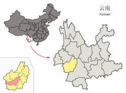 Location of Gengma County (pink) and Lincang City (yellow) within Yunnan province | |
 Gengma Location of the seat in Yunnan | |
| Coordinates: 23°32′17″N 99°23′49″E / 23.538°N 99.397°E | |
| Country | China |
| Province | Yunnan |
| Prefecture-level city | Lincang |
| County seat | Gengma |
| Area | |
| • Total | 3,837 km2 (1,481 sq mi) |
| Population (2020 census)[1] | |
| • Total | 285,683 |
| • Density | 74/km2 (190/sq mi) |
| Time zone | UTC+8 (CST) |
| Postal code | 677500 |
| Area code | 0883 |
| Website | www |
Gengma Dai and Va Autonomous County (simplified Chinese: 耿马傣族佤族自治县; traditional Chinese: 耿馬傣族佤族自治縣; pinyin: Gěngmǎ Dǎizú Wǎzú Zìzhìxiàn; Tai Nuea: ᥛᥫᥒᥰ ᥐᥪᥒ ᥛᥣᥳ; Awa: gaeng mīex) is located in Lincang City, in the west of Yunnan province, China.
History
The name of the Gengma come from the Pali word "Sinthunath" meaning a place where people follow white horses. People call this city's name was named after the Ming Dynasty's Hongwu period. and was written on the front cover "History of Burma" said Kung Ma
The main ethnic groups in the Gengma chieftains are Tai and Wa. The Tai people here moved from Mao Luang (Mong Mao) in the 14th century. They brought Mao Luang traditions with them. The original Wa people live in mountainous areas and do not have their own dialect.
In 1988, the county was affected by two strong earthquakes. It killed a total of 939 people and caused major destruction.[2]
Saophas
Gengma has 24 generation's soaphas
- Han Hso Hpa (Han Hso) 1397-1452
- Han Kyeng Hpa (Han Kyeng) 1452-1472
- Han Bieng Hpa (Han Bien) 1472-1502
- Han Xing Hpa (Han Xing) 1503-1557
- Han Ping Hpa (Han Ping) 1557-1601
- Han Möng Hpa 1601-1614 (son of Han Ping Hpa)
- Han Möng Kyin 1614-1633 (younger brother of Han Möng Hpa)
- Nang Xiao Li (Regent) queen of Han Möng Kyin 1633-1659
- Han Möng Bye 1659-1693 (son of Han Möng Hpa)
- Han Choo Kyaung 1693-1699 (son of Han Möng Hpa)
- Han Hso Fang (Han Hso Hpaeng) 1700-1732 (son of Han Choo Kyaung)
- Han Kwe Hkaing 1732-1765 (son of Han Hso Fang (Han Hso Hpaeng))
- Han Kwe Kang (Regent) 1765-1771 (younger brother of Han Kwe Hkaing)
- Han Kyao Ai 1771-1803 (first son of Han Kwe Hkaing)
- Han Hkoen Chow (Regent) 1803-1808 (son of Han Kyao Ai)
- Han Kyun Xiang 1808-1820 (first grand son of Han Kyao Ai and first son of Han Hkoen Chow)
- Han Ting Bi (Regent) 1820-1825 (second younger brother of Han Hkoen Chow)
- Chamawali (Regent) 1825-1836 (mother of Han En Pye)
- Han Oen Pye 1836-1851 (grandson of Han Ting Bi)
- Han Oen Hso 1852-1858 (younger brother of Han Oen Pye)
- Han Long Choeng 1858-1897 (second son of Han Oen Hso)
- Han Hkwa Chi (Han Fu Hpa) 1897-1915 (son of Han Long Choeng)
- Han Fu Goui 1915-1933 (son of Han Hkwa Chi (Han Fu Hpa))
- Han Fu Ting (Han Kyi Hpa) 1933-1950 (fifth younger brother of Han Fu Goui)
Administrative divisions
Gengma Dai and Va Autonomous County has 4 towns, 4 townships and 1 ethnic township.[3]
- 4 towns
|
|
- 4 townships
|
|
- 1 ethnic township
- Manghong Lahu and Bulang Ethnic Township (芒洪拉祜族布朗族乡)
Climate
| Climate data for Gengma (1991–2020 normals, extremes 1981–2010) | |||||||||||||
|---|---|---|---|---|---|---|---|---|---|---|---|---|---|
| Month | Jan | Feb | Mar | Apr | May | Jun | Jul | Aug | Sep | Oct | Nov | Dec | Year |
| Record high °C (°F) | 27.9 (82.2) |
31.0 (87.8) |
33.1 (91.6) |
35.3 (95.5) |
35.5 (95.9) |
36.5 (97.7) |
33.5 (92.3) |
33.4 (92.1) |
32.8 (91.0) |
32.2 (90.0) |
29.2 (84.6) |
27.1 (80.8) |
36.5 (97.7) |
| Mean daily maximum °C (°F) | 22.7 (72.9) |
24.9 (76.8) |
28.0 (82.4) |
29.7 (85.5) |
29.8 (85.6) |
29.0 (84.2) |
28.2 (82.8) |
29.0 (84.2) |
28.9 (84.0) |
27.2 (81.0) |
25.0 (77.0) |
22.6 (72.7) |
27.1 (80.8) |
| Daily mean °C (°F) | 12.8 (55.0) |
15.4 (59.7) |
19.1 (66.4) |
21.7 (71.1) |
23.3 (73.9) |
24.0 (75.2) |
23.5 (74.3) |
23.6 (74.5) |
22.9 (73.2) |
20.7 (69.3) |
16.6 (61.9) |
13.2 (55.8) |
19.7 (67.5) |
| Mean daily minimum °C (°F) | 5.8 (42.4) |
7.9 (46.2) |
11.7 (53.1) |
15.3 (59.5) |
18.6 (65.5) |
20.7 (69.3) |
20.9 (69.6) |
20.6 (69.1) |
19.4 (66.9) |
16.8 (62.2) |
11.3 (52.3) |
7.1 (44.8) |
14.7 (58.4) |
| Record low °C (°F) | −1.6 (29.1) |
0.7 (33.3) |
1.7 (35.1) |
8.6 (47.5) |
11.5 (52.7) |
15.4 (59.7) |
15.6 (60.1) |
16.1 (61.0) |
12.4 (54.3) |
7.2 (45.0) |
3.0 (37.4) |
−2.0 (28.4) |
−2.0 (28.4) |
| Average precipitation mm (inches) | 25.3 (1.00) |
14.5 (0.57) |
20.8 (0.82) |
58.4 (2.30) |
132.9 (5.23) |
180.5 (7.11) |
277.9 (10.94) |
220.8 (8.69) |
158.8 (6.25) |
127.1 (5.00) |
48.6 (1.91) |
14.5 (0.57) |
1,280.1 (50.39) |
| Average precipitation days (≥ 0.1 mm) | 3.3 | 3.2 | 5.2 | 11.1 | 16.4 | 23.2 | 26.2 | 22.7 | 17.9 | 15.1 | 6.2 | 3.6 | 154.1 |
| Average relative humidity (%) | 72 | 63 | 56 | 59 | 68 | 79 | 84 | 83 | 81 | 81 | 78 | 77 | 73 |
| Mean monthly sunshine hours | 222.9 | 222.3 | 234.1 | 225.4 | 209.6 | 146.1 | 115.3 | 142.5 | 160.7 | 169.3 | 194.2 | 207.7 | 2,250.1 |
| Percent possible sunshine | 66 | 69 | 63 | 59 | 51 | 36 | 28 | 36 | 44 | 48 | 59 | 63 | 52 |
| Source: China Meteorological Administration[4][5] | |||||||||||||
Ethnic groups
There are 1,004 Jingpo people located in the following five villages of Gengma County.[6]
- New Jingpo hamlet 景颇新寨, Mangkang Village 芒抗村, Hepai Township 贺派乡[7]
- Nalong 那拢组, Nongba Village 弄巴村, Gengma Town 耿马镇[8]
- Hewen 贺稳组, Jingxin Village 景信村, Mengding Town 孟定镇[9]
- Hebianzhai 河边寨, Qiushan Village 邱山村, Mengding Town 孟定镇[10]
- Caobazhai 草坝寨, Mang'ai Village 芒艾村, Mengding Town 孟定镇[11]
References
- ^ "临沧市第七次全国人口普查主要数据公报" (in Chinese). Government of Lincang. 2021-07-14.
- ^ Ramirez, Marizen; Peek-Asa, Corinne (2005). "Epidemiology of Traumatic Injuries from Earthquakes". Epidemiologic Reviews. 21 (1): 47–55. doi:10.1093/epirev/mxi005. PMID 15958426.
- ^ "国家统计局" (in Chinese). National Bureau of Statistics of the People's Republic of China. Retrieved 2021-12-07.
- ^ 中国气象数据网 – WeatherBk Data (in Simplified Chinese). China Meteorological Administration. Retrieved 20 September 2023.
- ^ 中国气象数据网 (in Simplified Chinese). China Meteorological Administration. Retrieved 20 September 2023.
- ^ Dai Qingxia [戴庆厦]. 2010. The Status Quo and Evolution of Language Use of The Jingpo Nationality in Gengma [耿马县景颇族语言使用现状及其演变]. Beijing: Commercial Press [商务印书馆]. ISBN 9787100071529
- ^ "耿马傣族佤族自治县贺派乡芒抗村民委员会景颇自然村". Archived from the original on 2015-09-25. Retrieved 2018-06-17.
- ^ "耿马傣族佤族自治县耿马镇弄巴村委会弄巴大寨(那拢)自然村". Archived from the original on 2015-09-25. Retrieved 2018-06-17.
- ^ "耿马傣族佤族自治县孟定镇景信村委会贺稳自然村". Archived from the original on 2015-09-25. Retrieved 2018-06-17.
- ^ "耿马傣族佤族自治县孟定镇邱山村委会河边寨自然村". Archived from the original on 2015-09-25. Retrieved 2018-06-17.
- ^ "耿马傣族佤族自治县孟定镇芒艾村委会". Archived from the original on 2015-09-25. Retrieved 2018-06-17.
External links
| International | |
|---|---|
| National | |
This Yunnan location article is a stub. You can help Wikipedia by expanding it. |