

Dar Kalateh (Persian: داركلاته)[a] is a village in, and the capital of, Fenderesk-e Jonubi Rural District (formerly Fenderesk Rural District)[4][5] of Fenderesk District, Ramian County, Golestan province, Iran.
At the 2006 National Census, its population was 1,824 in 490 households.[6] The following census in 2011 counted 1,934 people in 599 households.[7] The latest census in 2016 showed a population of 1,872 people in 616 households.[2]
Notes
References
- ^ OpenStreetMap contributors (13 February 2024). "Dar Kalateh, Ramian County" (Map). OpenStreetMap. Retrieved 13 February 2024.
- ^ a b "Census of the Islamic Republic of Iran, 1395 (2016)". AMAR (in Persian). The Statistical Center of Iran. p. 27. Archived from the original (Excel) on 29 March 2019. Retrieved 19 December 2022.
- ^ Dar Kalateh can be found at GEOnet Names Server, at this link, by opening the Advanced Search box, entering "-3768683" in the "Unique Feature Id" form, and clicking on "Search Database".
- ^ Habibi, Hassan (16 March 1380). "Approval letter regarding changing the name of Khormarud Rural District to Khormarud-e Jonubi Rural District". Lamtakam (in Persian). Ministry of Interior, Council of Ministers. Archived from the original on 13 February 2024. Retrieved 13 February 2024.
- ^ Mousavi, Mirhossein (18 May 1366). "Creation and establishment of 23 rural districts including villages, farms and places in Gonbad- Kavus County under Mazandaran province". Research Center of the System of Laws of the Islamic Council of the Farabi Library of Mobile Users (in Persian). Ministry of Interior, Board of Ministers. Archived from the original on 25 December 2013. Retrieved 19 November 2023.
- ^ "Census of the Islamic Republic of Iran, 1385 (2006)". AMAR (in Persian). The Statistical Center of Iran. p. 27. Archived from the original (Excel) on 20 September 2011. Retrieved 25 September 2022.
- ^ "Census of the Islamic Republic of Iran, 1390 (2011)". Syracuse University (in Persian). The Statistical Center of Iran. p. 27. Archived from the original (Excel) on 17 January 2023. Retrieved 19 December 2022.
Golestan Province, Iran | ||
|---|---|---|
| Capital | 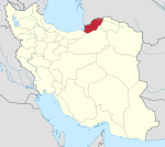 | |
| Counties and cities | ||
| Sights |
| |
| populated places | ||
| Capital | |||||||||||||
|---|---|---|---|---|---|---|---|---|---|---|---|---|---|
| Districts |
| ||||||||||||
This Ramian County location article is a stub. You can help Wikipedia by expanding it. |