
Canas | |
|---|---|
 Chilliwa (Festuca dolichophylla) growing at the Apurímac River in the Canas Province | |
 Flag | |
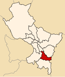 Location of Canas in the Cusco Region | |
| Country | Peru |
| Region | Cusco |
| Capital | Yanaoca |
| Government | |
| • Mayor | Juan Francisco Melendez Nina (2007) |
| Area | |
| • Total | 2,103.76 km2 (812.27 sq mi) |
| Population (2005 census) | |
| • Total | 42,368 |
| • Density | 20/km2 (52/sq mi) |
| UBIGEO | 0805 |
Canas Province is one of thirteen provinces in the Cusco Region in the southern highlands of Peru.
YouTube Encyclopedic
-
1/1Views:10 007
-
LETRAS Y MELODÌAS Carnaval de Canas
Transcription
Geography
The La Raya mountain range traverses the province. Some of the highest mountains of the province are listed below:[1]
- Anka Suka
- Aqu Saya
- Chimpulla
- Ch'iyar Jaqhi
- Ch'uwaña
- Hatun Ichhuna Kunka
- Hatun Ñan
- Huch'uy K'uchu
- Kunka
- Kuntur Sallana
- Kuntur Sinqa
- Laramani
- Mik'aya
- Pawka
- Pichaqani
- Puka Kancha
- Puka Urqu
- Pukara
- Q'ululu Kinray
- Sapan Warmi
- Tunka Suka
- Tuqtu
- Wanu Kunka
- Yana Ranra
- Yana Urqu
- Yawri Kunka
Political division
The province is divided into eight districts (Spanish: distritos, singular: distrito), each of which is headed by a mayor (alcalde). The districts, with their capitals in parentheses, are:
- Checca (Checca)
- Kunturkanki (El Descanso)
- Langui (Langui)
- Layo (Layo)
- Pampamarca (Pampamarca)
- Quehue (Quehue)
- Túpac Amaru (Tungasuca)
- Yanaoca (Yanaoca)
Ethnic groups
The people in the province are mainly indigenous citizens of Quechua descent. Quechua is the language which the majority of the population (91.62%) learnt to speak in childhood, 8.13% of the residents started speaking in Spanish.[2]
See also
References
- ^ escale.minedu.gob.pe - UGEL map of the Canas Province and the Melgar Province (Puno Region)
- ^ inei.gob.pe Archived January 27, 2013, at the Wayback Machine INEI, Peru, Censos Nacionales 2007
| |
|---|---|
| International | |
|---|---|
| National | |
14°13′05″S 71°25′54″W / 14.21806°S 71.43167°W
This Cusco Region geography article is a stub. You can help Wikipedia by expanding it. |