
   | |
| UTC time | 2004-11-11 21:26:41 |
|---|---|
| ISC event | 7434650 |
| USGS-ANSS | ComCat |
| Local date | November 12, 2004 |
| Local time | 05:26 WITA |
| Duration | 38 seconds |
| Magnitude | 7.5 Mw |
| Depth | 10.0 km (6.2 mi) |
| Epicenter | 8°10′01″S 124°49′23″E / 8.167°S 124.823°E |
| Type | Thrust fault |
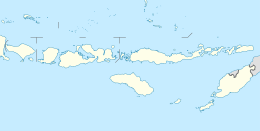
| Areas affected | Alor Island |
| Total damage | 7,656 buildings damaged 781 buildings destroyed |
| Max. intensity | VIII (Severe) |
| Aftershocks | 30 major, over 1,000 total |
| Casualties | 23 dead 234 injured |
The 2004 Alor earthquake occurred on the island of Alor at 21:26:41 UTC on 11 November. Alor is an island located in Indonesia, the largest island of the Alor Archipelago with almost 16,800 residents.[1] The earthquake had a magnitude of 7.5, on the moment magnitude scale, and an epicenter on Alor at a depth of 10 km (6.2 mi). It was recorded on 301 stations.[2] The epicenter of the earthquake was located 1,600 km (990 mi) east of the capital of Jakarta. Hundreds of homes and much infrastructure was damaged with 23 deaths and thousands of casualties.[3]

Geological background
Tectonic setting

Alor island is of volcanic origin, forming part of the Banda Arc, which was formed by the subduction of the Australian Plate beneath the Eurasian Plate. Currently the Banda Arc is involved in the early stages of an Arc-Continent collision, as continental crust of the Australian Plate becomes involved in this boundary.[5] Several microplates have been formed, including the Banda Sea Plate and the Timor Plate.The boundary between these two microplates is a north-dipping subduction zone, movement on which has caused large earthquakes in the past, including the 1991 Kalabahi earthquakes that resulted in 23 fatalities.[2]
Aftershocks
There were over 30 noticeable aftershocks between 11 May to 13 May, in the range from Mw 4.1 to 5.4. The aftershocks occurred almost hourly immediately after the mainshock.[2]
Tsunami
From the official website of the United States National Tsunami Warning Center, NOAA/NWS, according to the research of the Indonesian Meteorological and Geophysical Agency (BMKG), a tsunami followed with the tsunami reaching 50 meters inland.[6]
There were a series of subsequent effect on the local area:
Kalabahi city was severely damaged by the tsunami as well as from the continuous aftershocks of the earthquake. Located in the valley between hills, Bukapiting village, was completely destroyed. A landslide also caused by the earthquake destroyed the road that connects Kalabahi and Maritaing villages.
Maritaing beach, found 98 km (61 mi) north of Kalabahi village, was also hit by the tsunami. In Dali, a floating hotel in the natural harbor was pushed to the shore after the earthquake caused water to recede.
Some 649 houses were damaged and 205 of them were severely damaged or destroyed. There was large scale destruction of government infrastructure. Three schools and eight places of worship collapsed. The electricity grid of Alor island was shut down temporarily.
Moreover, airplanes were not able to land, because of the destruction of the local airport in Kalabahi city. Many cracks appeared in the runways, shutting down air services.
Historical earthquakes in nearby regions since 2000
On May 4, 2000, an earthquake measured at 7.6 Mwc, shook the Sulawesi Province, resulting in 35 deaths. Later the same year on June 4, a 7.9 Mwc earthquake, with an epicentre in Bengkulu Province, caused over 117 deaths.[7]
In 2004, on February 6, a 6.9 Mwc earthquake, occurred at Papua. The aftershocks caused over 34 deaths. Another, on November 26, 6.4 Mwc earthquake, centred near West Papua, caused over 30 deaths. At the end of the year, on Boxing Day, an earthquake and tsunami occurred in the seabed off Sumatra, which affected over 20 nearby countries and took over 220,000 lives.
In 2005, on March 28, an 8.7 Mwc earthquake, centred near Nias and Simeulue islands away from the Sumatra west shore, which caused over 900 deaths.
Another earthquake on May 27, 2006, measuring 6.4 Mwc, with an epicentre near the central city of Yogyakarta, caused over 5,000 deaths.
Damage and casualties
According to OCHA Situation Report No. 1[8]
| Conditions | Death | Severely injured | Slightly hurt |
|---|---|---|---|
| Number | 23 people | 116 people |
| Conditions | Totally destroyed | Severely destroyed | Slightly imparied |
|---|---|---|---|
| Number | 781 houses | 3,733 houses | 3,883 houses |
According to ABC News Online 14 November 2004[8] Many roads on Alor island have been badly damaged[9]
| Conditions | Death | Severely injured | Slightly hurt |
|---|---|---|---|
| Number | 19 people | 36 people | 76 people |
| Conditions | Totally collapsed | Severely damaged | Affected |
|---|---|---|---|
| Number | 93 houses | 791 houses | 1,000 houses |
Aftershocks from the earthquake continued for over half of a month, with large and widespread destruction of infrastructure including thousands of houses, schools, offices and places of worship although local hospitals mostly remained undamaged, the hospitals were unable to cope with large numbers of casualties.[10]
Social reactions
At the first phase of Alor earthquake November 2004, 4,500 affected households received emergency shelter and non-perishable material; after, the same number of households are assigned with the essential building material and basic tools[9]
According to the red cross document, the residual balance of CHF 420,054 (66% of the total emergency appeal income), was assigned to the Tsunami Emergency and Recovery Program 2005 - 2010 for Indonesia. The detailed composition of the funds' balance is in the following:
Donor Funds (CHF)
| Organizations | Australian Red Cross | Swedish Red Cross | Netherlands Red Cross | USAID | General Appeal-based Donors |
|---|---|---|---|---|---|
| Amount | 108,675 CHF | 85,000 CHF | 5,495 CHF | 168,870 CHF | 168,870 CHF |
And according to the UN Office for the Coordination of Humanitarian Affairs:
“cash assistance allocated by the central government has rounded about USD 172,000.”[11]
International Help
International assistance has been provided by the governments below
| Country | China | Australia | US | Denmark | JICA |
|---|---|---|---|---|---|
| Amount | USD 37,200 | USD 37,200 | USD 50,000 | USD 26,000 | USD 125,000 |
International organizations involved are:
IFRC, MSF-B, WVI, CRS, CWS, Oxfam GB, and GTZ-Siskes.[11]
Reconstruction of the earthquake
Infrastructure is now being reinforced by anti-seismic design with the shock-resistant technology; mostly in houses and the schools. They are mostly able to resist earthquakes measuring to 8 on the Richter scale.[12]
Memorial
The disaster is commemorated on 10 December of every year with most of the local schools gather and singing songs to the national flag. The local government and media will also memorize that earthquake on TV channels and official websites by documentary films and videos. The total amount of help donated to victims is US$ 420,054.
Impact on economy
All industries were affected in the short and long term. The residents in Alor island still practice subsistence agriculture with poorly developed infrastructure which is prone to frequent natural disasters.[13] Another main industry on the island is the fishing industry and the mining industry with natural gas, ipsum, kaolin, petroleum, tin, gold and various diamond mines on the island.[13] The island is a recognised diving destination, making local tourism one of the major income source of Alor inhabitants, with mainly diving and snorkeling.[13][14][15]
References
- ^ Badan Pusat Statistik Kabupaten Alor. (2010). Hasil Sensus Penduduk 2010 Kabupaten Alor [Ebook]. Retrieved from http://sp2010.bps.go.id/files/ebook/5307.pdf
- ^ a b c "M 7.5 - Kepulauan Alor, Indonesia". earthquake.usgs.gov. Retrieved 2019-05-17.
- ^ "Indonesia: Earthquake Situation Report 16 Nov 2004 - Indonesia". ReliefWeb. 16 November 2004. Retrieved 2019-05-17.
- ^ IFRC. (2004). First contact with earthquake survivors in Indonesia. Retrieved from https://www.ifrc.org/es/noticias/noticias/asia-pacific/indonesia/first-contact-with-earthquake-survivors-in-indonesia/?print=true
- ^ A. Shulgin; H. Kopp; C. Mueller; E. Lueschen; L. Planert; M. Engels; E. R. Flueh; A. Krabbenhoeft & Y. Djajadihardja (May 27, 2009). "Sunda-Banda arc transition, Incipient continent-island arc collision (northwest Australia)". Geophysical Research Letters. 36 (10): L10304. Bibcode:2009GeoRL..3610304S. doi:10.1029/2009gl037533.
- ^ Service, National Weather. "National Weather Service - Tsunami Hazards". www.tsunami.gov. Retrieved 2019-05-17.
- ^ "Timeline: Earthquakes and tsunami in Indonesia since 2000 - Asia - Pacific - International Herald Tribune". The New York Times. 2006-07-18. ISSN 0362-4331. Retrieved 2019-05-17.
- ^ a b "Asian Disaster Reduction Center(ADRC)". www.adrc.asia. Retrieved 2019-05-17.
- ^ a b IFRC. (2004). First contact with earthquake survivors in Indonesia. Retrieved from https://www.ifrc.org/es/noticias/noticias/asia-pacific/indonesia/first-contact-with-earthquake-survivors-in-indonesia/?print=true
- ^ IFRC (International Federation of Red Cross) And Red Crescent Societies. (2004). Indonesia earthquakes: Final report. International Federation of Red Cross And Red Crescent Societies.
- ^ a b "Indonesia: OCHA Humanitarian Update Nov 2004 - Indonesia". ReliefWeb. 30 November 2004. Retrieved 2019-05-17.
- ^ Becker, N. (2009). Raising preparedness by risk analysis of post‐disaster homelessness and improvement of emergency shelters. Disaster Prevention And Management: An International Journal, 18(1), 49-54. doi: 10.1108/09653560910938529
- ^ a b c "Alor island - pictures, maps and information". www.lavalontouristinfo.com. Retrieved 2019-05-30.
- ^ Maugeri, M., & Soccodato, C. (2014). Earthquake geotechnical engineering design. Dordrecht: Springer.
- ^ ZuBlu (2019-05-25). "Alor". ZuBlu. Retrieved 2019-05-30.