
Puriscal | |
|---|---|
 Flag  Seal | |
 Puriscal canton | |
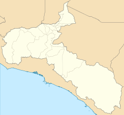 Puriscal Puriscal canton location in San José Province  Puriscal Puriscal canton location in Costa Rica | |
| Coordinates: 9°43′59″N 84°22′21″W / 9.7330278°N 84.3726231°W | |
| Country | |
| Province | San José |
| Creation | 26 June 1914[1] |
| Head city | Santiago |
| Districts | |
| Government | |
| • Type | Municipality |
| • Body | Municipalidad de Puriscal |
| • Mayor | Iris Cristina Arroyo Hererra (PLN) |
| Area | |
| • Total | 553.66 km2 (213.77 sq mi) |
| Elevation | 945 m (3,100 ft) |
| Population (2011) | |
| • Total | 33,004 |
| • Density | 60/km2 (150/sq mi) |
| Time zone | UTC−06:00 |
| Canton code | 104 |
| Website | munipuriscal |
Puriscal is the 4th canton in the province of San José, Costa Rica.[2][3]
The head city of the canton is Santiago.
Toponymy
In Spanish, a purisco is the flower of the common bean. A puriscal is a field of flowering beans.
Geography
Puriscal has an area of 553.66 km²[4] and a mean elevation of 945 metres.[2]
Chucás River delineates the canton's northernmost boundary, while the Chires River marks its far southern border, with the canton of Parrita in Puntarenas Province. Puriscal includes a significant portion of the Coastal Mountain Range. However, the canton is landlocked.
Demographics
| Historical population | |||
|---|---|---|---|
| Census | Pop. | %± | |
| 1883 | 1,942 | — | |
| 1892 | 6,845 | 252.5% | |
| 1927 | 13,329 | 94.7% | |
| 1950 | 16,743 | 25.6% | |
| 1963 | 23,690 | 41.5% | |
| 1973 | 24,150 | 1.9% | |
| 1984 | 23,123 | −4.3% | |
| 2000 | 29,407 | 27.2% | |
| 2011 | 33,004 | 12.2% | |
|
Instituto Nacional de Estadística y Censos[5] |
|||
For the 2011 census, Puriscal had a population of 33,004 inhabitants.[7]
Only 18% of the canton's population live in urban areas. Among its inhabitants, 20.2% are under ten, and 7.4% are over 65.
Districts
The canton of Puriscal is subdivided into the following districts:
History
Purical canton was established by decree on 7 August 1868.
Transportation
Road transportation
The following road routes cover the canton:
References
- ^ Hernández, Hermógenes (1985). Costa Rica: evolución territorial y principales censos de población 1502 - 1984 (in Spanish) (1 ed.). San José: Editorial Universidad Estatal a Distancia. pp. 164–173. ISBN 9977-64-243-5. Retrieved 5 October 2020.
- ^ a b "Declara oficial para efectos administrativos, la aprobación de la División Territorial Administrativa de la República N°41548-MGP". Sistema Costarricense de Información Jurídica (in Spanish). 19 March 2019. Retrieved 26 September 2020.
- ^ División Territorial Administrativa de la República de Costa Rica (PDF) (in Spanish). Editorial Digital de la Imprenta Nacional. 8 March 2017. ISBN 978-9977-58-477-5.
- ^ "Área en kilómetros cuadrados, según provincia, cantón y distrito administrativo". Instituto Nacional de Estadística y Censos (in Spanish). Retrieved 26 September 2020.
- ^ "Instituto Nacional de Estadística y Censos" (in Spanish).
- ^ "Sistema de Consulta de a Bases de Datos Estadísticas". Centro Centroamericano de Población (in Spanish).
- ^ "Censo. 2011. Población total por zona y sexo, según provincia, cantón y distrito". Instituto Nacional de Estadística y Censos (in Spanish). Retrieved 26 September 2020.
| International | |
|---|---|
| National | |