
Mora | |
|---|---|
 Ciudad Colón, aerial view | |
 Flag  Seal | |
 Mora canton | |
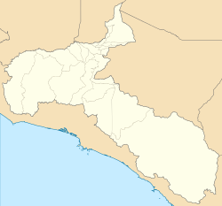 Mora Mora canton location in San José Province  Mora Mora canton location in Costa Rica | |
| Coordinates: 9°52′21″N 84°16′48″W / 9.8724731°N 84.2801252°W | |
| Country | |
| Province | San José |
| Creation | 25 May 1883[1] |
| Head city | Colón |
| Districts | |
| Government | |
| • Type | Municipality |
| • Body | Municipalidad de Mora |
| • Mayor | Rodrigo Jiménez Cascante (PNG) |
| Area | |
| • Total | 162.04 km2 (62.56 sq mi) |
| Elevation | 807 m (2,648 ft) |
| Population (2011) | |
| • Total | 26,294 |
| • Density | 160/km2 (420/sq mi) |
| Time zone | UTC−06:00 |
| Canton code | 107 |
| Website | mora |
Mora is the seventh canton in the San José province of Costa Rica.[2][3]
YouTube Encyclopedic
-
1/5Views:7 66150065417 482 684681
-
What is a mora? [Phonology #2.1]
-
A princesa que mora no livro, de Katia Canton | Livros Infantis Estrela Cultural
-
Journey to the Grisons Part 1
-
Yes Yes Brush Your Teeth | CoComelon Nursery Rhymes & Kids Songs
-
TABACARÍ, Santuario, Cavernas, Poza, Catarata, Costa Rica, Cantón de Mora, Puriscal.
Transcription
Toponymy
Originally designated as Pacaca, a cacique name, the canton's name was changed to Mora in honor of Juan Rafael Mora Porras (1814-1860), the second President of Costa Rica.
History
The canton of Pacaca was established by a decree of 25 May 1883.
Geography
Mora has an area of 162.04 km²[4] and a mean elevation of 807 metres.[2]
The Virilla River establishes the northern boundary of the canton, with the Grande de Tárcoles River delineating its far western limit. The Chucás, Quebrada Grande, Viejo and Tabarcia rivers mark the canton's western boundary; the Jorco, Tabarcia and Negro rivers, the southern boundary; and a series of foothills rising into the Cerros de Escazú delineate the canton's eastern border.
Districts
The canton of Mora is subdivided into six districts
Demographics
| Historical population | |||
|---|---|---|---|
| Census | Pop. | %± | |
| 1883 | 6,976 | — | |
| 1892 | 5,814 | −16.7% | |
| 1927 | 7,925 | 36.3% | |
| 1950 | 7,736 | −2.4% | |
| 1963 | 8,938 | 15.5% | |
| 1973 | 10,733 | 20.1% | |
| 1984 | 12,584 | 17.2% | |
| 2000 | 21,666 | 72.2% | |
| 2011 | 26,294 | 21.4% | |
|
Instituto Nacional de Estadística y Censos[5] |
|||
For the 2011 census, Mora had a population of 26,294 inhabitants. [7]
Transportation
Road transportation
The canton is covered by the following road routes:
References
- ^ Hernández, Hermógenes (1985). Costa Rica: evolución territorial y principales censos de población 1502 - 1984 (in Spanish) (1 ed.). San José: Editorial Universidad Estatal a Distancia. pp. 164–173. ISBN 9977-64-243-5. Retrieved 5 October 2020.
- ^ a b "Declara oficial para efectos administrativos, la aprobación de la División Territorial Administrativa de la República N°41548-MGP". Sistema Costarricense de Información Jurídica (in Spanish). 19 March 2019. Retrieved 26 September 2020.
- ^ División Territorial Administrativa de la República de Costa Rica (PDF) (in Spanish). Editorial Digital de la Imprenta Nacional. 8 March 2017. ISBN 978-9977-58-477-5.
- ^ "Área en kilómetros cuadrados, según provincia, cantón y distrito administrativo". Instituto Nacional de Estadística y Censos (in Spanish). Retrieved 26 September 2020.
- ^ "Instituto Nacional de Estadística y Censos" (in Spanish).
- ^ "Sistema de Consulta de a Bases de Datos Estadísticas". Centro Centroamericano de Población (in Spanish).
- ^ "Censo. 2011. Población total por zona y sexo, según provincia, cantón y distrito". Instituto Nacional de Estadística y Censos (in Spanish). Retrieved 26 September 2020.
This Costa Rican location article is a stub. You can help Wikipedia by expanding it. |