
Chal
چال | |
|---|---|
 Location of Chal in Takhar Province | |
| Coordinates (district center): 36°31′41″N 69°32′20″E / 36.528°N 69.539°E | |
| Country | |
| Province | Takhār |
| Area | |
| • Total | 330.8 km2 (127.7 sq mi) |
| Population (2019)[2] | |
| • Total | 31,337 |
| • Density | 95/km2 (250/sq mi) |
| Time zone | UTC+4:30 (Afghanistan Standard Time) |
Chal District (Dari: چال) is a district of Takhar Province, Afghanistan. It was considered to be largely under control of the Afghan government in 2018.
YouTube Encyclopedic
-
1/5Views:6699621 223710560
-
USER18-MRP_2
-
USER 13 - Module Warehouse and Logisitc (WHS)
-
OCPS | 2020-12-08 School Board Meeting
-
USER20-Human Resource (HCM)
-
USER21-Customer Services
Transcription
Geography
Chal has an area of 331 kilometers, comparatively equivalent to the area of Komodo Island.[3] The main river running through the district is the Chal River, which is a tributary of the Khanabad River.
Chal is bordered by Taluqan District to the north, Namak Ab District to the east, Guzargahi Nur District to the southeast, Ishkamish District to the south, and Bangi District to the west. Guzargahi is located in Baghlan Province, with all other districts in Takhar Province.[4]
58 villages are located in Chal.[1]
History
Chal was created in 1975 by a cartographer in service of Mohammed Zahir Shah. The district was not mapped until 1998 by AIMS.[5] Chal was captured by the Taliban on June 5 2001,[6] and was subsequently retaken in the US invasion of Afghanistan.
From 2017 to 2020, Chal has been relatively peaceful in the Taliban insurgency. The BBC considered it to be under full governmental control in late 2017, which meant that it is attacked, at most, once in three months by the Taliban.[7] SIGAR classified it as under Government of Afghanistan influence.[8] About 3000 votes were cast in the district as part of the 2019 Afghan presidential election.[5]
Demographics
The district has a population of 31337 and a sex ratio of 24 males for every 20 females. The median age is 16.5 and about 40% of the population is working. 10% of the unemployed are seeking a job. The district is home to about 5,000 households, with an average size of about 6.3 people.[9]
See also
References
- ^ a b "Chal District Development Plan" (PDF). mrrd-nabdp.org. March 2006. Archived from the original (PDF) on 13 March 2016. Retrieved 13 September 2020.
- ^ "Estimated Population of Afghanistan 19-20" (PDF). nsia.gov.af. Archived from the original (PDF) on 9 June 2020. Retrieved 13 September 2020.
- ^ "Islands by Land Area". unep.ch. Archived from the original on 1 December 2015. Retrieved 1 October 2020.
- ^ "Afg: Takhar Province - Reference Map | HumanitarianResponse". www.humanitarianresponse.info. Retrieved 13 September 2020.
- ^ a b "Afghanistan District Maps". www.arcgis.com. Retrieved 1 October 2020.
- ^ Gutkin, Stephen (5 June 2001). "Opposition: Captures Afghan District". Washington Post. Retrieved 3 October 2020.
- ^ Adamou, Shoaib Sharifi and Louise (31 January 2018). "Taliban 'threaten 70% of Afghanistan'". BBC News. Retrieved 1 October 2020.
- ^ SIGAR (30 January 2018). "Addendum to SIGAR's January 2018 Report to the United States Congress" (PDF). sigar.mil. p. 15. Retrieved 1 October 2020.
- ^ "Takhar Socio-Demographic and Economic Survey". UNFPA Afghanistan. 5 January 2017. Retrieved 3 October 2020.
| Districts | 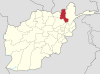 | |
|---|---|---|
| Populated Places | ||
| Other | ||