
Kiti
کیتی | |
|---|---|
 Kiti Location within Afghanistan [1] | |
| Coordinates: 33°32′24″N 65°43′12″E / 33.54000°N 65.72000°E | |
| Country | Afghanistan |
| Province | Daykundi |
| Area | |
| • Total | 1,453 km2 (561 sq mi) |
| Elevation | 1,400 m (4,600 ft) |
| Population (2005) | |
| • Total | 59,974 |
Kiti or Keti (Persian: کیتی), is a district in Daykundi province in central Afghanistan.[2] It was created in 2005 from the former Kajran district. The main village Kiti is at 1,783 m altitude.
YouTube Encyclopedic
-
1/5Views:1 9765 7566 5842 2404 839
-
معرفی منطقه سنگینک ولسوالی کیتی دایکندی Sanginak Village of Kiti district, Daikundi
-
معرفی تمران گلستان ولسوالی کیتی، دایکندی Beautiful Temran, Kiti, Daikundi
-
معرفی منطقه هزار درخت زیبا و دیدنی، ولسوالی کیتی ولایت دایکندی
-
معرفی منطقه کومی، کیتی، دایکندی Beautiful Kawmai, Kiti, Daikundi
-
وضعیت کار و زندگی مردم زحمتکش تکه تو ولسوالی کیتی ولایت دایکندی
Transcription
District profile
- Villages: 180.[citation needed]
- Schools: 20 primary, 3 high schools, 1 religious.[citation needed]
- Health centers: 2 clinics, 1 maternity clinic.[citation needed]
- Main agricultural products: almond, fig, apricot.[citation needed]
References
- ^ "District Names". National Democratic Institute. Archived from the original on 29 January 2016. Retrieved 5 May 2015.
- ^ "Daykundi Province ‐ Socio‐demographic and Economic Survey Highlights" (PDF). Central Statistics Organization of Afghanistan. Archived from the original (PDF) on 18 May 2015. Retrieved 5 May 2015.
External links
| Districts | 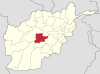 | |
|---|---|---|
| Landforms | ||
| Other | ||
This Daykundi Province, Afghanistan location article is a stub. You can help Wikipedia by expanding it. |