
Chapa Dara
چپه دره | |
|---|---|
District | |
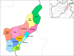 Chapa Dara district (in red) within the province of Kunar. | |
 Chapa Dara Location in Afghanistan | |
| Coordinates: 34°58′58″N 70°45′58″E / 34.98278°N 70.76611°E | |
| Country | |
| Province | Kunar |
| Capital | Chapa Dara |
| Government | |
| • district governor | Khalilullah Khalili[1] |
| Population (2006) | |
| • Total | 27,500 |
| Time zone | UTC+4:30 |
Chapa Dara District (Pashto: چپه دره ولسوالۍ) is situated in the western part of Kunar Province, Afghanistan and borders Nuristan Province.[2][3] The population is 27,500 (2006). The district consists of a mountainous terrain. The capital of the district is Chapa Dara.
The district borders Nuristan Province to the north and northwest, Laghman Province to the southwest, and the Pech and Nurgal districts of Kunar Province to the east and south respectively.
The population of the district is predominantly Pashtun and Pashai. In the Digal valley region, remnants of the Indo-Aryan Nangalami (Grangali) language is still spoken in two villages.
History
NATO helicopter crash
On July 25, 2011, a NATO attack helicopter crashed in the Chapa Dara region. The Taliban claimed they shot it down.[4]
Government clearing operations
On 22 October 2018, the Ministry of Defense claimed that they killed 11 insurgents in airstrikes and clearing operations in Chapa Dara.[5]
Islamic State attack
In late March 2019, a local chapter of the self-declared Islamic State attacked and took over the valleys of Lindalam and Digal from the Taliban in Chapa Dara district. The government stayed in control of the main valley formed by the Pech river. 11 Islamic State fighters and two Taliban were killed and nine Islamic State fighters and one other Taliban were wounded. Local officials asserted that there are 200 to 250 Islamic State fighters in Chapa Dara.[1]
The violence forced thousands of families to flee their homes. Despite these numbers, there are no sprawling refugee camps in Chapa Dara. Some displaced people are staying in the houses of relatives, where – as usual across Afghanistan – extended families live together in small spaces. Others have received tents from the Afghan government that are randomly tucked away here and there. These families became dependent on aid by the World Food Programme and the United States Agency for International Development.[1]
On 11 July 2019, the Taliban claimed that they regained control of parts of Chapa Dara from Islamic State.[6][7][8]
References
- ^ a b c Marty, Franz J. "The Peculiar Presence of the Islamic State in Kunar". thediplomat.com. Retrieved 2020-12-26.
- ^ AIMS District Map
- ^ District Profile
- ^ "Nato-Helikopter in Ostafghanistan abgestürzt". Neue Zürcher Zeitung (in German). 2011-07-25. Retrieved 2011-07-25.
- ^ "11 insurgents killed, 4 wounded and 4 weapons were destroyed in ANA airstrikes and clearing operations in Chapa Dara". Ministry of Defense of Afghanistan. 22 October 2018. Retrieved 27 December 2020.
- ^ "Pro #Taliban accounts are claiming that Chapa Dara area is cleansed from #Khurasan presence". twitter.com/RisboLensky. 11 July 2019. Retrieved 27 December 2020.
- ^ "#Taliban took control over Sulaiman Shah area in Chapa Dara district". twitter.com/RisboLensky. 6 July 2019. Retrieved 27 December 2020.
- ^ "According to @Shahin_Tangi Chalas area and Korengal are the last #Khurasan outposts in #Kunar". twitter.com/RisboLensky. 7 January 2020. Retrieved 27 December 2020.
| Districts |  | |
|---|---|---|
| Populated places | ||
| Other | ||
This Kunar Province, Afghanistan location article is a stub. You can help Wikipedia by expanding it. |