
Yesagyo Township | |
|---|---|
 Location in Pakokku district | |
 Yesagyo Township Location in Burma | |
| Coordinates: 21°35′N 95°11′E / 21.583°N 95.183°E | |
| Country | |
| Division | Magway Division |
| District | Pakokku District |
| Time zone | UTC+6:30 (MST) |
| Area code | 062 |
| [1] | |
Yesagyo Township (Yaesagyo Township) is a township of Pakokku District in the Magway Region of central Burma (Myanmar). The principal town and administrative seat is Yesagyo.
The township is served by the Chaung-U to Pakokku railway.
YouTube Encyclopedic
-
1/1Views:332
-
Yesagyo Pyin Nyar Dar Na- Small Discussion with Interview with Dr. Thein Lwin
Transcription
Borders
Yesagyo is the easternmost township of Magway Region. The Chindwin River and then the Irradwaddy form the eastern boundary of the township except for a small area on the eastern side of the Chindwin directly across from the town of Yesagyo,[2] which area was formerly an island in the Chindwin.[3] Yesagyo Township is bounded by the following townships:[4]
- Salingyi Township, Sagaing region, to the north;
- Chaung-U Township and Myaung Township of Sagaing Region, to the northeast;
- Myingyan Township and Taungtha Township of Mandalay Region to the southeast;
- Pakokku Township to the southwest; and
- Myaing Township to the west.
Sights
The wooden Pakhangyi Monastery on brick foundations was constructed by King Mindon in 1886 and restored in 1992.[5] In 1992 the Pakhangyi Archaeological Museum was opened there. In 1996 Burma applied for World Heritage Site status for the site.[6]
Notes
- ^ "National Telephone Area Codes". Myanmar's Net.
- ^ "Magway Division, Myanmar" map ID: MIMU270v01, creation date:15 Jul 2010, Myanmar Information Management Unit (MIMU)
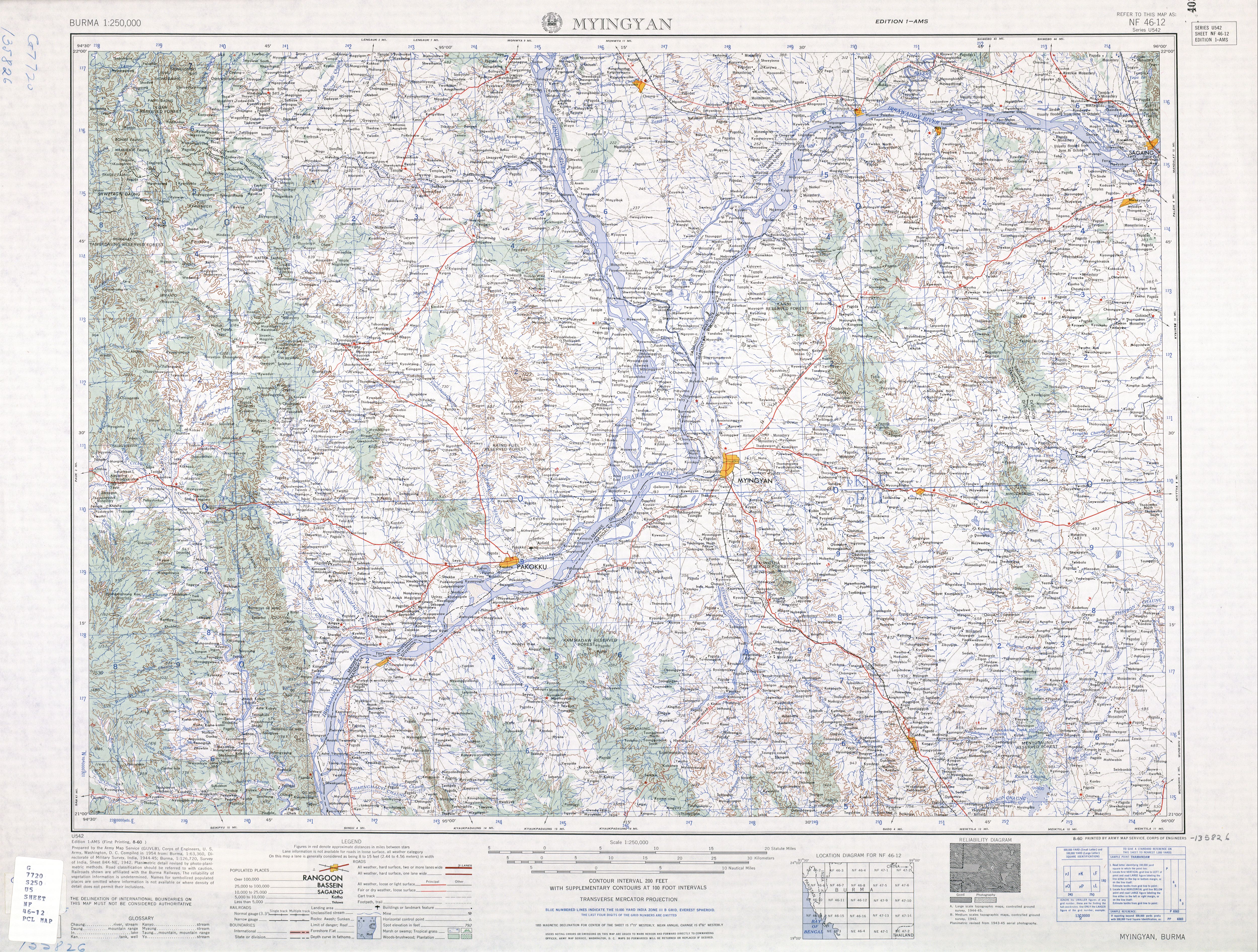
- ^ "Burma 1:250,000 topographic map, Series U542, NF 46-12, Myingyin" U.S. Army Map Service, August 1960
- ^ "Myanmar States/Divisions & Townships Overview Map" Myanmar Information Management Unit (MIMU)
- ^ "Pakhangyi monastery" Asterism Travels & Tours - Myanmar
- ^ "Wooden Monasteries of Konbaung Period: Ohn Don, Sala, Pakhangyi, Pakhannge, Legaing, Sagu, Shwe-Kyaung (Mandalay) (04/10/1996)" Tentative Lists UNESCO World Heritage Centre
External links
- "Yesagyo Township - Magway Division" map ID: MIMU154v01, creation date: 5 June 2010, Myanmar Information Management Unit (MIMU)
- "Yesagyo Google Satellite Map" Maplandia World Gazetteer
Capital: Magway | ||
| Gangaw District |
|   |
| Magway District | ||
| Minbu District | ||
| Pakokku District | ||
| Thayet District | ||
| Main cities and towns | ||
This Myanmar location article is a stub. You can help Wikipedia by expanding it. |