

Seikphyu Township [2] is a township of Pakokku District in Magway Division of Burma (Myanmar). The principal town and administrative seat is Seikphyu. The township has its southeastern border along the Irrawaddy where its principal town, Seikphyu, is a port. The township lies between 20° 51' and 21° 15' north latitude and 94° 09' and 94° 48' east longitude. The Yaw River forms the township's eastern boundary.[3] It is one of the areas destroyed by Cyclone Giri on 23 October 2010.[4][5][6]
Borders
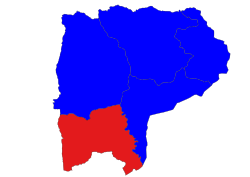
Seikphyu Township is bordered[7] by:
- Pauk Township, to the north,
- Pakokku Township, to the northeast and east,
- Chauk Township, to the southeast,
- Salin Township, to the south, and
- Saw Township, to the west.
Economy
Agriculture is the major economy of the township. Onion from Seikphyu Township is famous in onion market of Myanmar. Onion is grown along the sandbank of Yaw River from December to April.
Secret projects
The State Peace and Development Council is constructing 2 secret nuclear suspected military projects on the northern side of Seikphyu Township along with other secret projects in Mindon, Padan, Pwintbyu, Sidoktaya, Salin, Pakkoku, Laung Shay (in Saw Township) and Saw Townships.[8] Actually, the sites in Seikphyu Township are 2 factories for the production of military weapons and are not the nuclear projects.
Notes
- ^ "Cyclone GIRI - "Who is Assessing Where"" Myanmar Information Management Unit (MIMU), 10 October 2010
- ^ "Archived copy" (PDF). Archived from the original (PDF) on 2013-08-16. Retrieved 2013-03-06.
{{cite web}}: CS1 maint: archived copy as title (link) - ^ "Seik Phyu Township - Magway Division" Archived 2010-11-17 at the Wayback Machine map from Myanmar Information Management Unit (MIMU)
- ^ Reliefweb Updates, Myanmar: Flash floods Hit Pakokku
- ^ Myanmar Information Management Unit (MIMU), UNDP, Map of Cyclone Giri Archived 2011-06-22 at the Wayback Machine
- ^ DREF Operation Update, Myanmar Cyclone Giri
- ^ "Myanmar States/Divisions & Townships Overview Map" Myanmar Information Management Unit (MIMU)
- ^ The Irrawaddy, Junta Constructing Tunnel in Magway
External links
- Admin map, 2011, Myanmar Information Management Unit (MIMU)
- "Seikpyu Google Satellite Map" map of administrative area with listing of principal settlements, from Maplandia World Gazetteer
- "Seik Phyu Township - Magway Division"[permanent dead link] map, 8 June 2010, Myanmar Information Management Unit (MIMU)
Capital: Magway | ||
| Gangaw District |
|   |
| Magway District | ||
| Minbu District | ||
| Pakokku District | ||
| Thayet District | ||
| Main cities and towns | ||