
Whitewater Township | |
|---|---|
 Snow Hill Covered Bridge | |
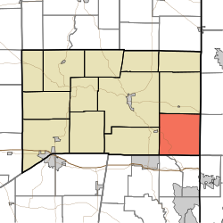 Location of Whitewater Township in Franklin County | |
| Coordinates: 39°20′55″N 84°52′18″W / 39.34861°N 84.87167°W | |
| Country | United States |
| State | Indiana |
| County | Franklin |
| Government | |
| • Type | Indiana township |
| Area | |
| • Total | 35.21 sq mi (91.2 km2) |
| • Land | 34.98 sq mi (90.6 km2) |
| • Water | 0.23 sq mi (0.6 km2) |
| Elevation | 889 ft (271 m) |
| Population (2020) | |
| • Total | 2,706 |
| • Density | 77/sq mi (30/km2) |
| FIPS code | 18-84068[2] |
| GNIS feature ID | 454057 |
Whitewater Township is one of thirteen townships in Franklin County, Indiana. As of the 2020 census, its population was 2,706,[3] up from 2,684 at 2010.[4]
| Census | Pop. | Note | %± |
|---|---|---|---|
| 1890 | 1,237 | — | |
| 1900 | 1,154 | −6.7% | |
| 1910 | 1,150 | −0.3% | |
| 1920 | 1,122 | −2.4% | |
| 1930 | 984 | −12.3% | |
| 1940 | 1,011 | 2.7% | |
| 1950 | 1,110 | 9.8% | |
| 1960 | 1,255 | 13.1% | |
| 1970 | 1,393 | 11.0% | |
| 1980 | 1,925 | 38.2% | |
| 1990 | 1,890 | −1.8% | |
| 2000 | 2,360 | 24.9% | |
| 2010 | 2,684 | 13.7% | |
| 2020 | 2,706 | 0.8% | |
| Source: US Decennial Census[5] | |||
YouTube Encyclopedic
-
1/3Views:361342405
-
Brookville Fossil Hunt - Science Summer Safari Family & Teacher Expeditions
-
CAMPFEST1- WHITEWATER CAMPGROUND LOOP.mov
-
Welcome to the Johnson County Museum in Franklin, Indiana
Transcription
History
Whitewater Township was created in 1816.[6]
The Snow Hill Covered Bridge and Salmon Turrell Farmstead are listed on the National Register of Historic Places.[7]
Geography
According to the 2010 census, the township has a total area of 35.21 square miles (91.2 km2), of which 34.98 square miles (90.6 km2) (or 99.35%) is land and 0.23 square miles (0.60 km2) (or 0.65%) is water.[4]
Unincorporated towns
- Ashby (extinct)
- Drewersburg
- New Trenton
- Rockdale
- Sharptown
(This list is based on USGS data and may include former settlements.)
Major highways
Cemeteries
The township contains two cemeteries: Otwell and Snow.
References
- ^ "US Board on Geographic Names". United States Geological Survey. October 25, 2007. Retrieved January 31, 2008.
- ^ "U.S. Census website". United States Census Bureau. Retrieved January 31, 2008.
- ^ "Explore Census Data". data.census.gov. Retrieved April 10, 2024.
- ^ a b "Population, Housing Units, Area, and Density: 2010 - County -- County Subdivision and Place -- 2010 Census Summary File 1". United States Census. Archived from the original on February 12, 2020. Retrieved May 10, 2013.
- ^ "Township Census Counts: STATS Indiana".
- ^ Reifel, August Jacob (1915). History of Franklin County, Indiana. Windmill Publications. pp. 127.
- ^ "National Register Information System". National Register of Historic Places. National Park Service. July 9, 2010.
External links
Places adjacent to Whitewater Township, Franklin County, Indiana | |
|---|---|
Municipalities and communities of Franklin County, Indiana, United States | ||
|---|---|---|
| City |  | |
| Towns | ||
| Townships | ||
| CDPs | ||
| Other communities |
| |
| Footnotes | ‡This populated place also has portions in an adjacent county or counties | |
This Franklin County, Indiana location article is a stub. You can help Wikipedia by expanding it. |