
Laurel Township | |
|---|---|
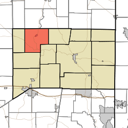 Location of Laurel Township in Franklin County | |
| Coordinates: 39°29′03″N 85°11′28″W / 39.48417°N 85.19111°W | |
| Country | United States |
| State | Indiana |
| County | Franklin |
| Government | |
| • Type | Indiana township |
| Area | |
| • Total | 31.74 sq mi (82.2 km2) |
| • Land | 31.5 sq mi (82 km2) |
| • Water | 0.23 sq mi (0.6 km2) |
| Elevation | 709 ft (216 m) |
| Population (2020) | |
| • Total | 1,400 |
| • Density | 44/sq mi (17/km2) |
| FIPS code | 18-42390[2] |
| GNIS feature ID | 453544 |
Laurel Township is one of thirteen townships in Franklin County, Indiana. As of the 2020 census, its population was 1,400,[3] down from 1,634 at 2010.[4]
| Census | Pop. | Note | %± |
|---|---|---|---|
| 1890 | 1,760 | — | |
| 1900 | 1,412 | −19.8% | |
| 1910 | 1,209 | −14.4% | |
| 1920 | 1,294 | 7.0% | |
| 1930 | 1,285 | −0.7% | |
| 1940 | 1,284 | −0.1% | |
| 1950 | 1,662 | 29.4% | |
| 1960 | 1,625 | −2.2% | |
| 1970 | 1,509 | −7.1% | |
| 1980 | 1,739 | 15.2% | |
| 1990 | 1,462 | −15.9% | |
| 2000 | 1,650 | 12.9% | |
| 2010 | 1,634 | −1.0% | |
| 2020 | 1,400 | −14.3% | |
| Source: US Decennial Census[5] | |||
YouTube Encyclopedic
-
1/3Views:5153542 504
-
Driving South on St Rt 121 Through Laurel, In
-
Spartan Race Laurel, IN, USA Sat, Apr 21st, 2012 beginning of the race.
-
Driving Through the Megatropolis of Brookville, In
Transcription
History
Laurel Township was established in 1845.[6]
Geography
According to the 2010 census, the township has a total area of 31.74 square miles (82.2 km2), of which 31.5 square miles (82 km2) (or 99.24%) is land and 0.23 square miles (0.60 km2) (or 0.72%) is water.[4] Triple Lakes is in this township.
Cities and towns
Unincorporated towns
Adjacent townships
- Columbia Township, Fayette County (north)
- Jackson Township, Fayette County (northeast)
- Blooming Grove Township (east)
- Metamora Township (southeast)
- Salt Creek Township (southwest)
- Posey Township (west)
- Orange Township, Fayette County (northwest)
Major highways
Cemeteries
The township contains three cemeteries: Gobel, Jenks and North.
Education
Laurel Township residents may obtain a free library card from the Franklin County Public Library District in Brookville.[7]
References
- "Laurel Township, Franklin County, Indiana". Geographic Names Information System. United States Geological Survey, United States Department of the Interior. Retrieved September 24, 2009.
- United States Census Bureau cartographic boundary files
- ^ "US Board on Geographic Names". United States Geological Survey. October 25, 2007. Retrieved January 31, 2008.
- ^ "U.S. Census website". United States Census Bureau. Retrieved January 31, 2008.
- ^ "Explore Census Data". data.census.gov. Retrieved April 10, 2024.
- ^ a b "Population, Housing Units, Area, and Density: 2010 - County -- County Subdivision and Place -- 2010 Census Summary File 1". United States Census. Archived from the original on February 12, 2020. Retrieved May 10, 2013.
- ^ "Township Census Counts: STATS Indiana".
- ^ Reifel, August Jacob (1915). History of Franklin County, Indiana. Windmill Publications. pp. 176.
- ^ "Policies". Franklin County Public Library District. Retrieved March 7, 2018.
External links
Municipalities and communities of Franklin County, Indiana, United States | ||
|---|---|---|
| City |  | |
| Towns | ||
| Townships | ||
| CDPs | ||
| Other communities |
| |
| Footnotes | ‡This populated place also has portions in an adjacent county or counties | |
This Franklin County, Indiana location article is a stub. You can help Wikipedia by expanding it. |