
Viterbo, Caldas | |
|---|---|
Municipality and town | |
 Flag | |
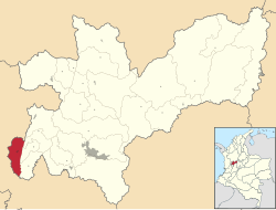 Location of the municipality and town of Viterbo, Caldas in the Caldas Department of Colombia. | |
 Viterbo, Caldas Location in Colombia | |
| Coordinates: 5°3′38″N 75°52′24″W / 5.06056°N 75.87333°W | |
| Country | |
| Department | |
| Area | |
| • Total | 172 km2 (66 sq mi) |
| Elevation | 998 m (3,274 ft) |
| Population (Census 2018[2]) | |
| • Total | 12,432 |
| • Density | 72/km2 (190/sq mi) |
| Time zone | UTC-5 (Colombia Standard Time) |
Viterbo is a town and municipality in the Colombian Department of Caldas. Formally constituted as a municipality on December 31, 1951, it was founded on April 19, 1911 by Presbítero Nazario Restrepo Botero. The current mayor is Jhon Mario Giraldo Arrubla. They call it "El Paraiso Turistico de Caldas" (The Touristic Paradise of The Colombian Department of Caldas. It is known as this due to its all year through warm climate, Villas, Farms and Condominiums around the surrounding land, and the welcoming people of the 'Viterbeños' (Viterbo People).
YouTube Encyclopedic
-
1/3Views:2 6972 295380
-
Entrando a Viterbo Caldas
-
Viterbo Caldas carrera 7
-
Recorrido Viterbo Caldas Pereira Risaralda Parte 1
Transcription
Location
The town is situated between the Risaralda River Valley and the foothills of the Cordillera Occidental. It is close to the city of Pereira and near three other cities, Manizales, Cali and Medellín. These cities are connected by good, easy to travel roads. It also has nearby air connections: Matecaña International airport in Pereira and Santa Ana international airport near Cartago. It is also known as "El Paraíso de Caldas" (the paradise of Caldas) due to the beautiful landscape, the notable condos surrounding it, wide streets and recreational facilities.
Local Economy
The local economy of Viterbo is based largely around agriculture and farming, with principal exports including sugarcane, corn, citrus, tropical fruit and some coffee. There is also an emerging tourism industry with the boom in vacationing condos construction
External links
- Viterbo tourism (domain appears to be for sale as of November 20, 2010)
- (in Spanish) Official site
- (in Spanish) www.tuviterbo.com
References
- ^ "Municipalities of Colombia". statoids. Retrieved 30 April 2020.
- ^ "Censo Nacional de Población y Vivienda 2018" (in Spanish). DANE. Retrieved 30 April 2020.
5°04′N 75°53′W / 5.067°N 75.883°W
Capital: Manizales | |||||||||||||
| Districts and municipalities |
| ||||||||||||
This Caldas Department location article is a stub. You can help Wikipedia by expanding it. |