
Tuen Mun Hospital 屯門醫院 | ||||||||||||||||
|---|---|---|---|---|---|---|---|---|---|---|---|---|---|---|---|---|
| MTR Light Rail stop | ||||||||||||||||
 Tuen Mun Hospital stop's Platform | ||||||||||||||||
| General information | ||||||||||||||||
| Location | Tuen Mun Hospital Tuen Mun District Hong Kong | |||||||||||||||
| Owned by | KCR Corporation | |||||||||||||||
| Operated by | MTR Corporation | |||||||||||||||
| Line(s) | 610 751 | |||||||||||||||
| Platforms | 2 side platforms | |||||||||||||||
| Tracks | 2 | |||||||||||||||
| Connections | ||||||||||||||||
| Construction | ||||||||||||||||
| Structure type | At-grade | |||||||||||||||
| Accessible | Yes | |||||||||||||||
| Other information | ||||||||||||||||
| Station code | TMH (English code) 090 (Digital code) | |||||||||||||||
| Fare zone | 3 | |||||||||||||||
| History | ||||||||||||||||
| Opened | 18 September 1988 | |||||||||||||||
| Services | ||||||||||||||||
| ||||||||||||||||
| Location | ||||||||||||||||
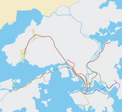 Tuen Mun Hospital Location within the MTR system | ||||||||||||||||
Tuen Mun Hospital (Chinese: 屯門醫院) is an at-grade MTR Light Rail stop located between Tuen Mun Hospital and Tuen Mun River in Tuen Mun District. It began service on 18 September 1988 and belongs to Zone 3. It serves Tuen Mun Hospital and nearby areas.[1]
YouTube Encyclopedic
-
1/3Views:10 89443 733546
-
All The Lines #8 | West Rail Line
-
Proposed MTR Extensions | The Future of Hong Kong's Railways
-
CHIP with or without MCS (Mechanical Circulatory Support)
Transcription
References
- ^ "Tuen Mun Hospital Stop" (PDF). MTR Corporation. Retrieved 30 March 2024.
22°24′28″N 113°58′37″E / 22.40778°N 113.97694°E
This MTR- or MTR Corporation-related article is a stub. You can help Wikipedia by expanding it. |