
Tai Hing (North) 大興 (北) | ||||||||||||||||
|---|---|---|---|---|---|---|---|---|---|---|---|---|---|---|---|---|
| MTR Light Rail stop | ||||||||||||||||
 Tai Hing (North) stop's Platform | ||||||||||||||||
| General information | ||||||||||||||||
| Location | Tai Hing Estate Tuen Mun District Hong Kong | |||||||||||||||
| Owned by | KCR Corporation | |||||||||||||||
| Operated by | MTR Corporation | |||||||||||||||
| Line(s) | 507 610 | |||||||||||||||
| Platforms | 3 side platforms | |||||||||||||||
| Tracks | 3 | |||||||||||||||
| Connections | ||||||||||||||||
| Construction | ||||||||||||||||
| Structure type | At-grade | |||||||||||||||
| Accessible | Yes | |||||||||||||||
| Other information | ||||||||||||||||
| Station code | THN (English code) 212 (Digital code) | |||||||||||||||
| Fare zone | 2 | |||||||||||||||
| History | ||||||||||||||||
| Opened | 18 September 1988 | |||||||||||||||
| Services | ||||||||||||||||
| ||||||||||||||||
| Location | ||||||||||||||||
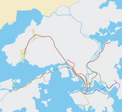 Tai Hing (North) Location within the MTR system | ||||||||||||||||
Tai Hing (North) (Chinese: 大興 (北)) is an at-grade MTR Light Rail stop located at Tai Fong Street near Shi Hui Wen Secondary School, Tai Hing Estate, in Tuen Mun District.[1] It began service on 18 September 1988 and belongs to Zone 2. It serves the north of Tai Hing Estate.
YouTube Encyclopedic
-
1/3Views:5421 850435
-
MTR Train on the East Rail Line
-
MTR Mong Kok Station Hong Kong
-
Metro Cammell bus
Transcription
References
- ^ "Tai Hing (North) Stop & Tai Hing (South) Stop" (PDF). MTR Corporation. Retrieved 12 August 2021.
22°24′17″N 113°58′13″E / 22.40472°N 113.97028°E